Five months ago, I left off my last post having just left Canyonlands National Park, heading further south to visit Bryce Canyon and Zion National Parks. I had booked a motel for the evening in Panguitch, Utah, which is a three or four hour drive from Moab. The drive there was uneventful, with relatively little in the way of scenery. I mostly followed the interstate, until about an hour outside of Panguitch, where I exited onto state route 89.
Route 89 winds through scrub desert, farmland, and several very small towns nestled between modest mountains. I arrived in Panguitch and discovered that it, too, is very small. In contrast to Moab, though, it didn't seem to have much of a tourist draw despite its proximity to Bryce Canyon. As a foreigner, I have to admit that I felt some apprehension at this. Although everyone I'd met in Utah so far had been very friendly and welcoming, a small, isolated town like Panguitch is the kind of place where I imagined that I could encounter a Top Gear-esque redneck mob. Granted, I wasn't driving around with a purposefully offensive slogan on my car, nor do I really have a discernible accent, but I still felt like a pretty obvious outsider with my Washington plates and conspicuous blue car with absurd spoiler. I was relieved, then, when I checked in at the New Western Motel and was greeted at the front desk by an older Indian man (who I presume is also the owner); it was good to see that the population of Panguitch isn't completely homogeneous.
If you read the previous post you might recall that I had only slept for a few hours the previous night, as I was up around 3:30am to get pictures of Delicate Arch at night. That being the case, I was exhausted by the time I checked into my room, so I decided to nap for a few hours before heading to Bryce Canyon. It might have just been because I was so tired, but I distinctly recall thinking that the bed in my motel room was among the most comfortable I had ever slept in.
I woke up around five or six in the evening and went to grab dinner from "The Pizza Place" in the nearby town of Tropic. Yes, it's literally just called "The Pizza Place." It's a nice little family-run business, and the pizza was pretty good. I couldn't help but notice that they had several copies of the Book of Mormon available for guests to peruse. That didn't surprise me, given that I was in Utah, but I did find it strange that most if not all of the books seemed to be written in Danish.
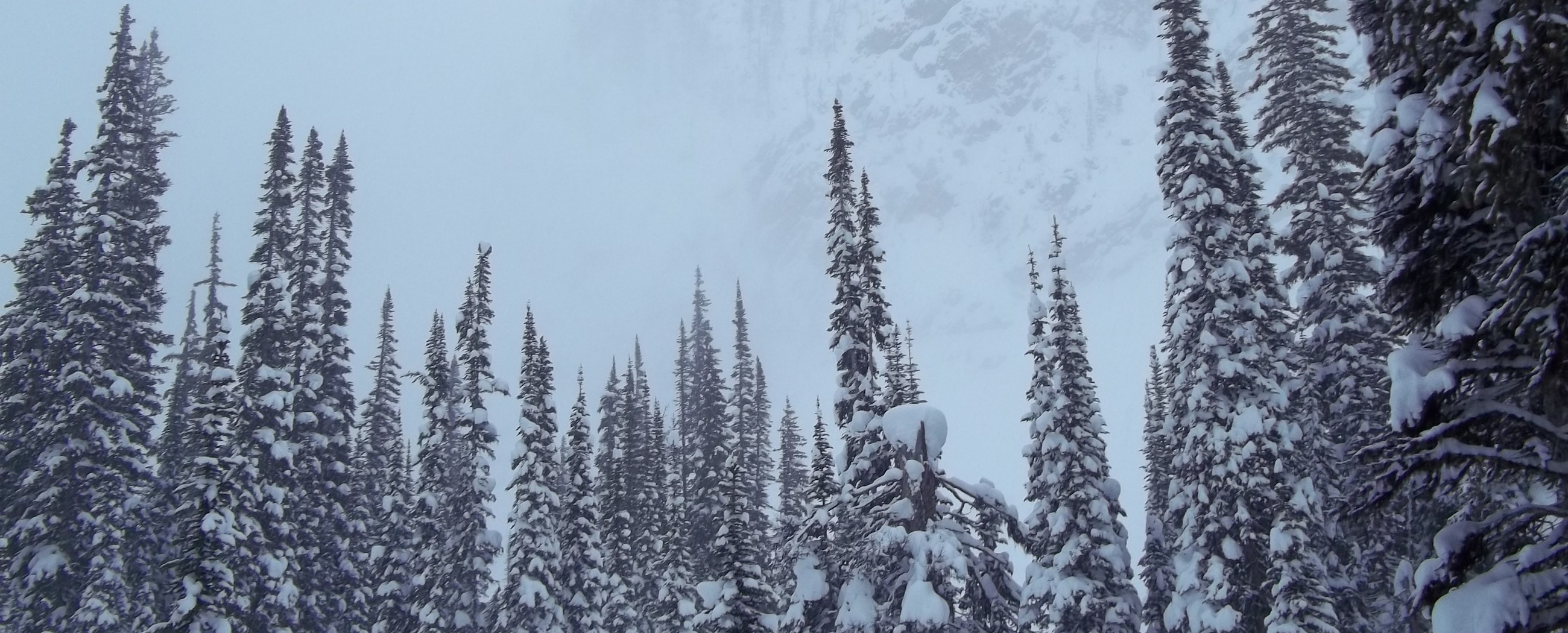
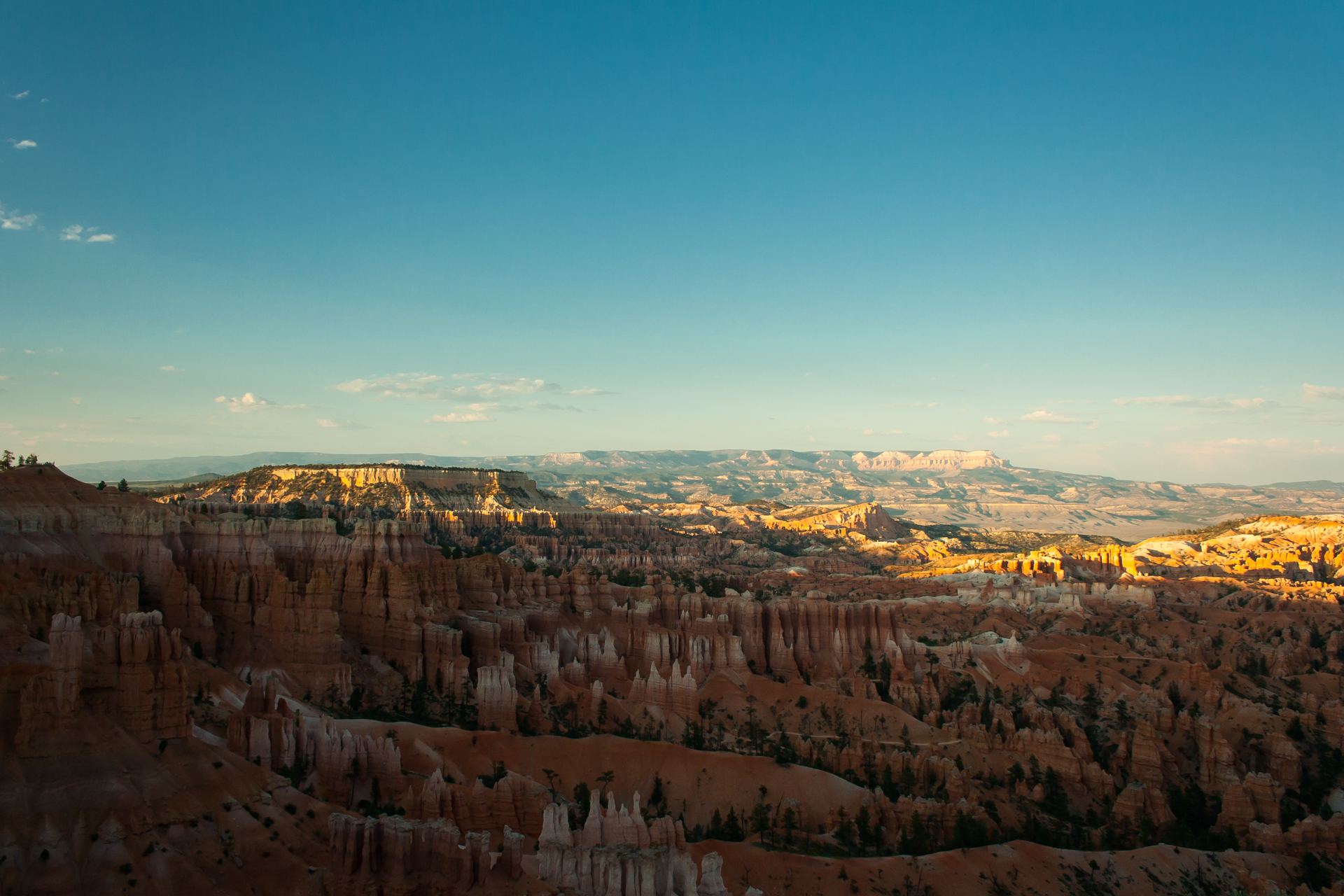
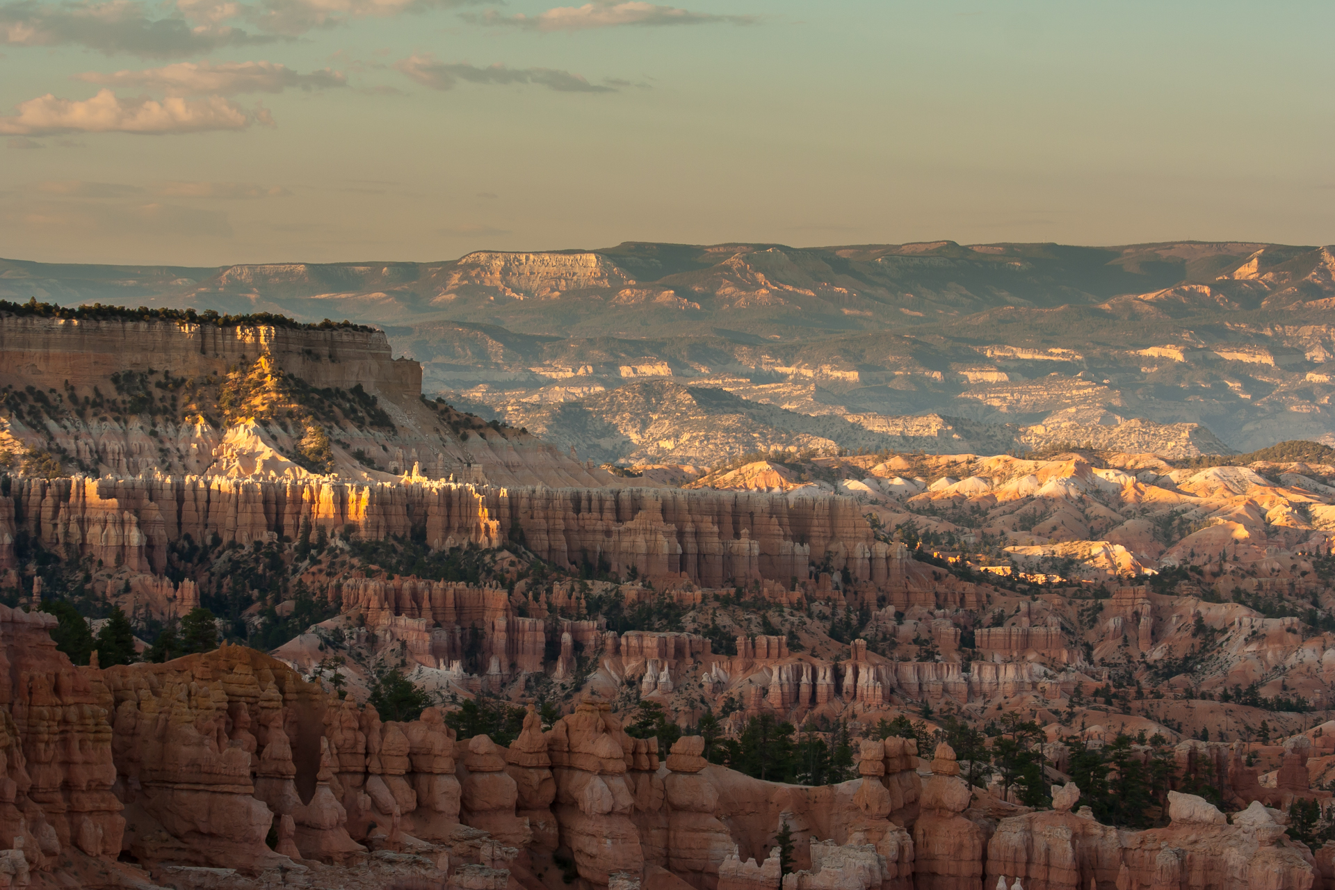
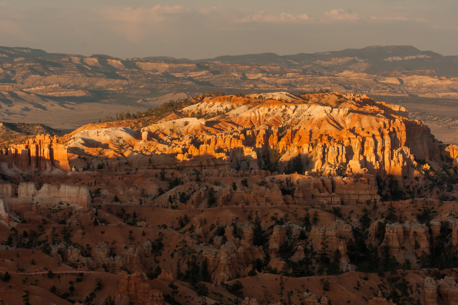
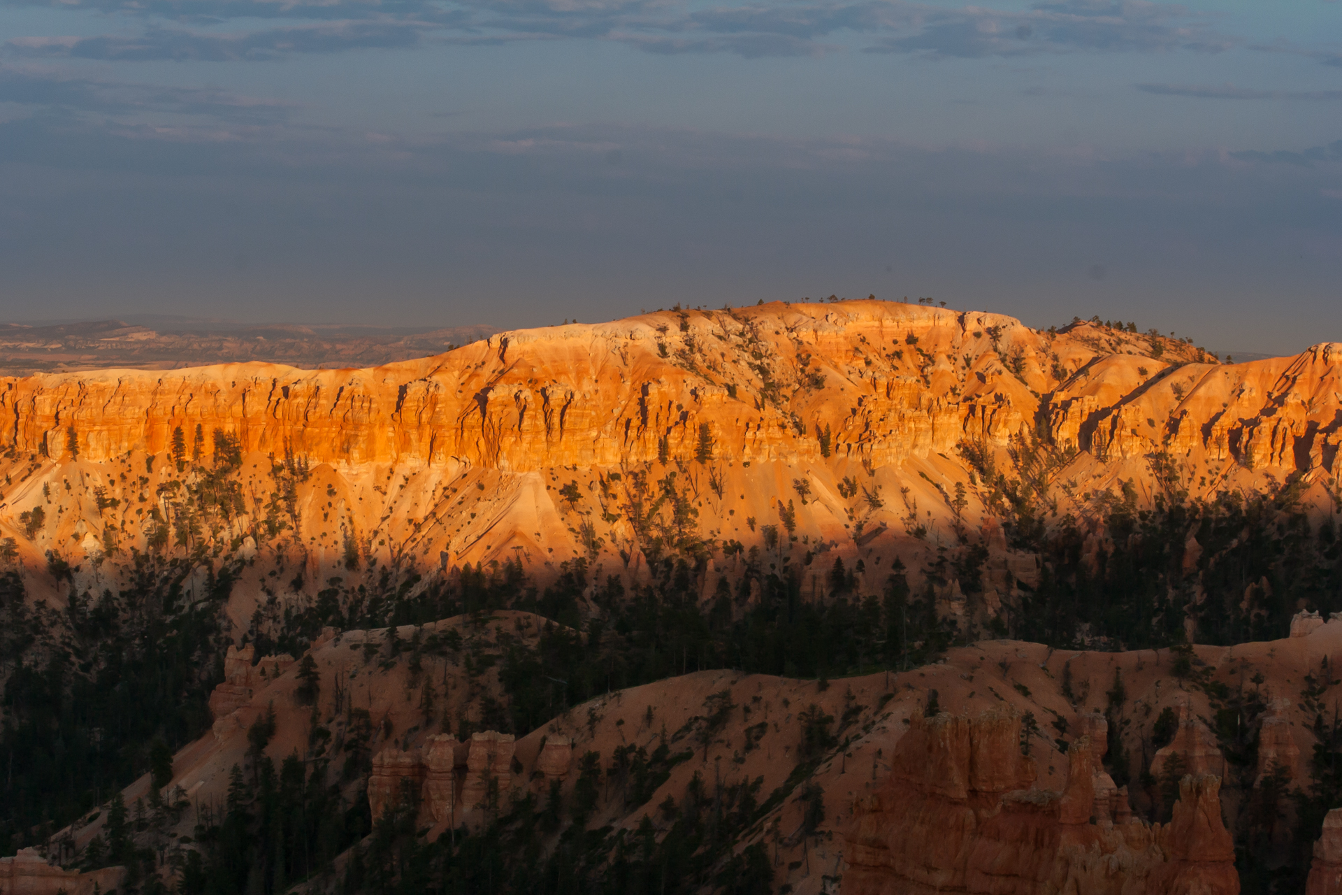
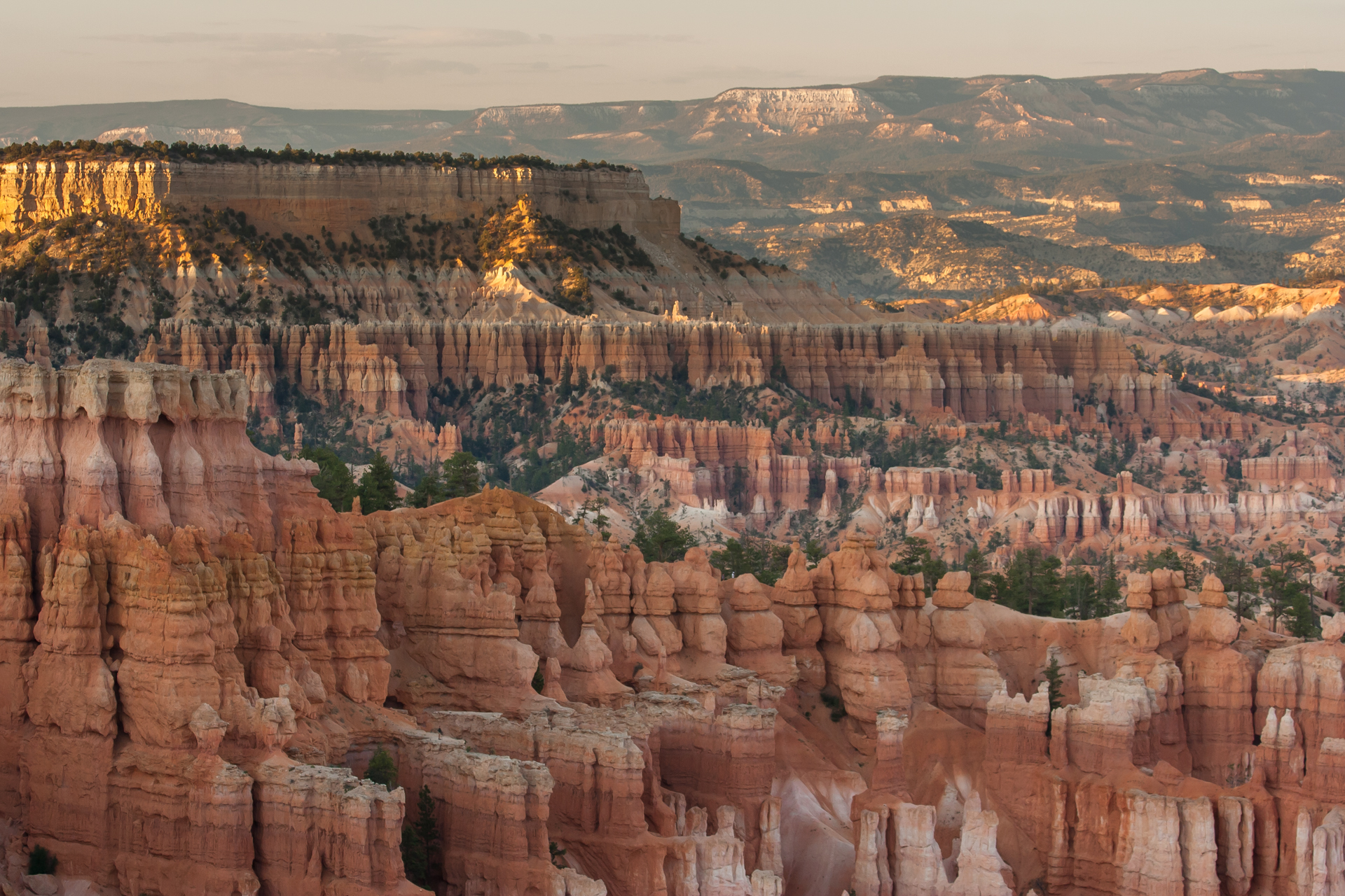
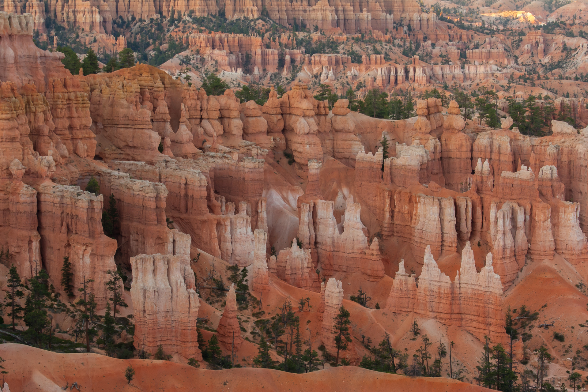
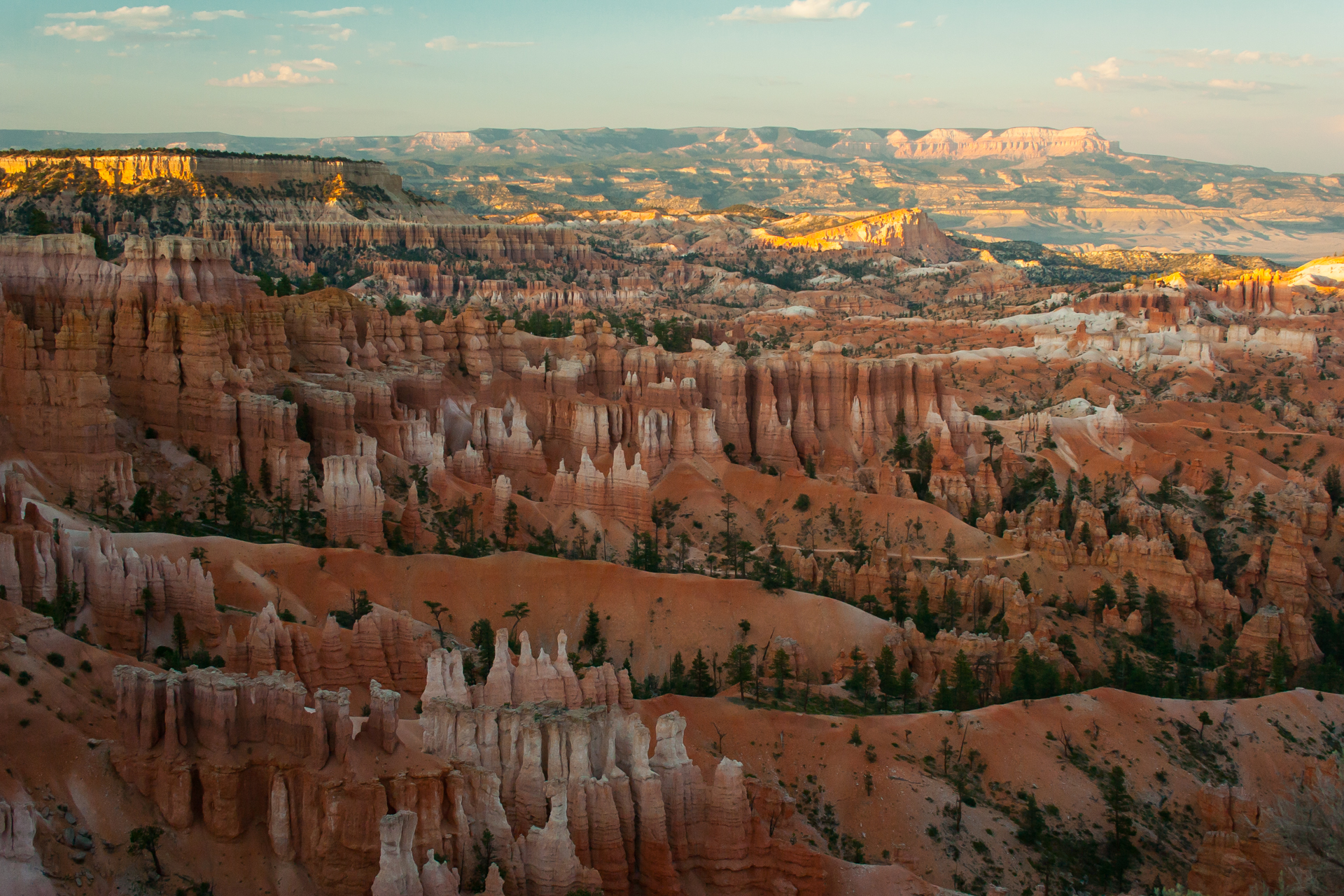
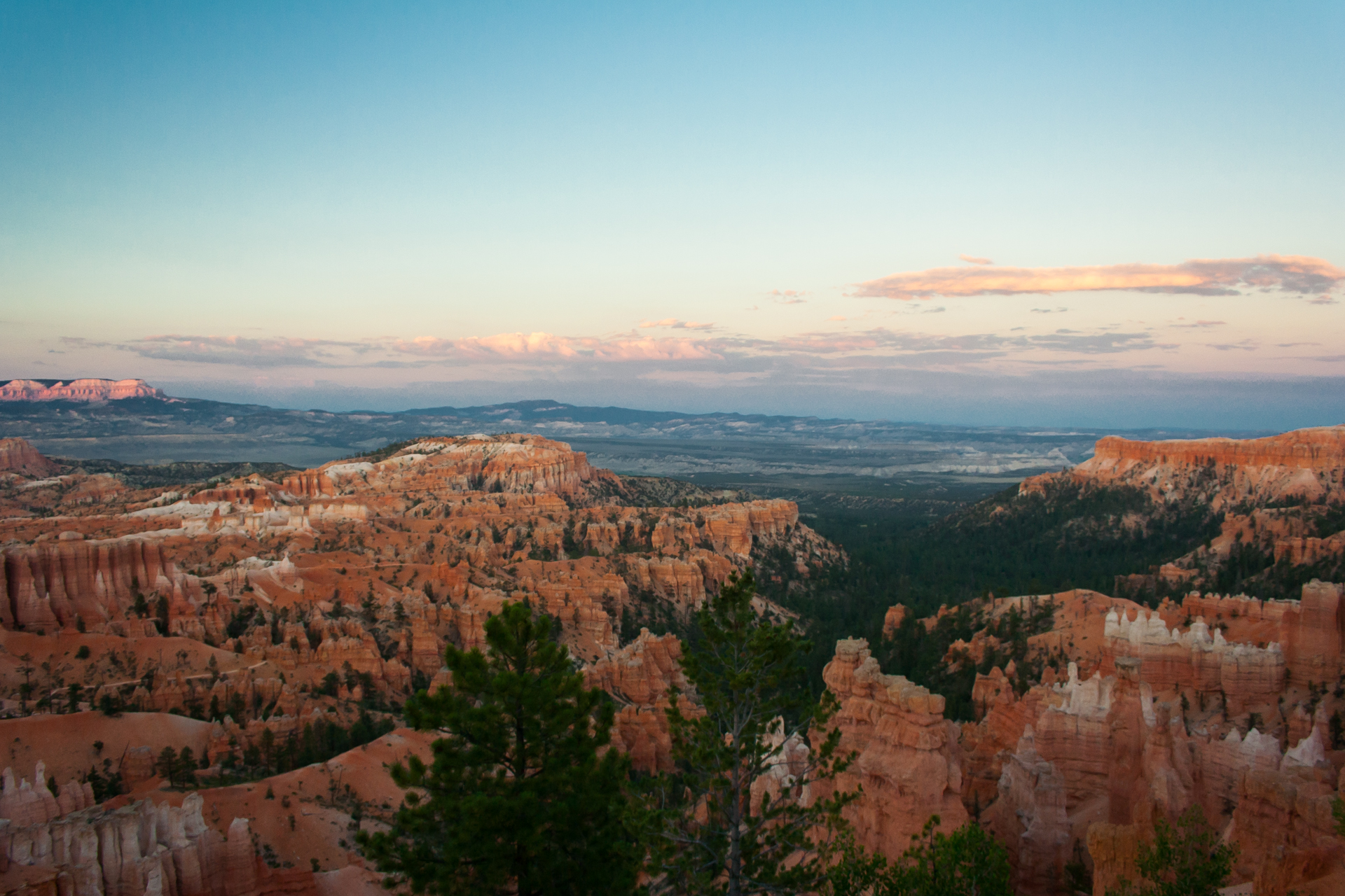
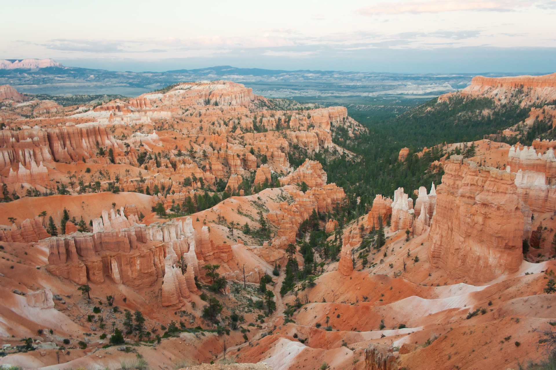
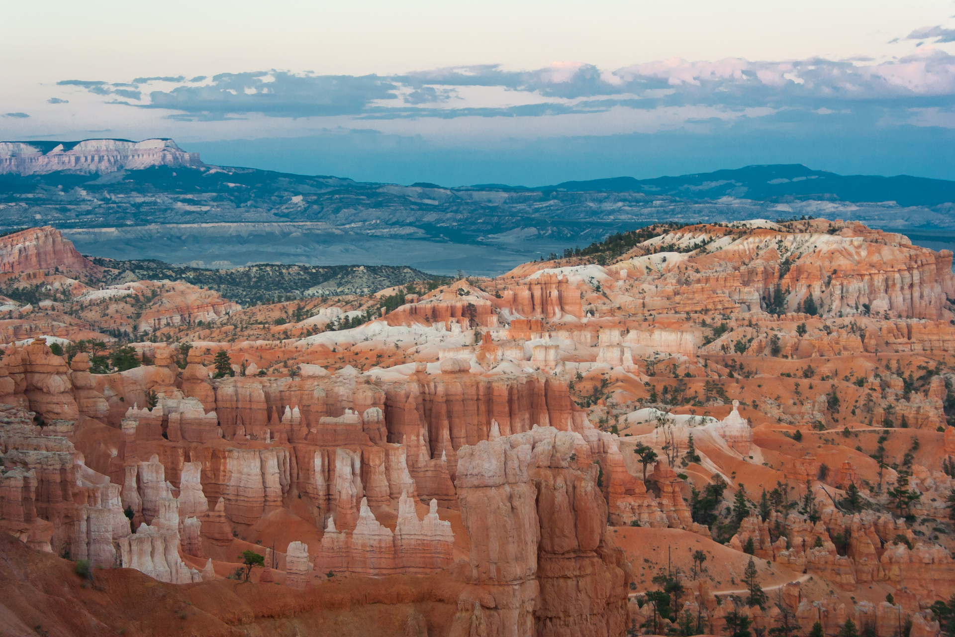
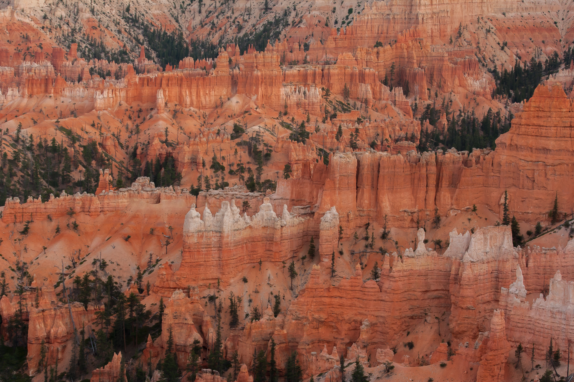
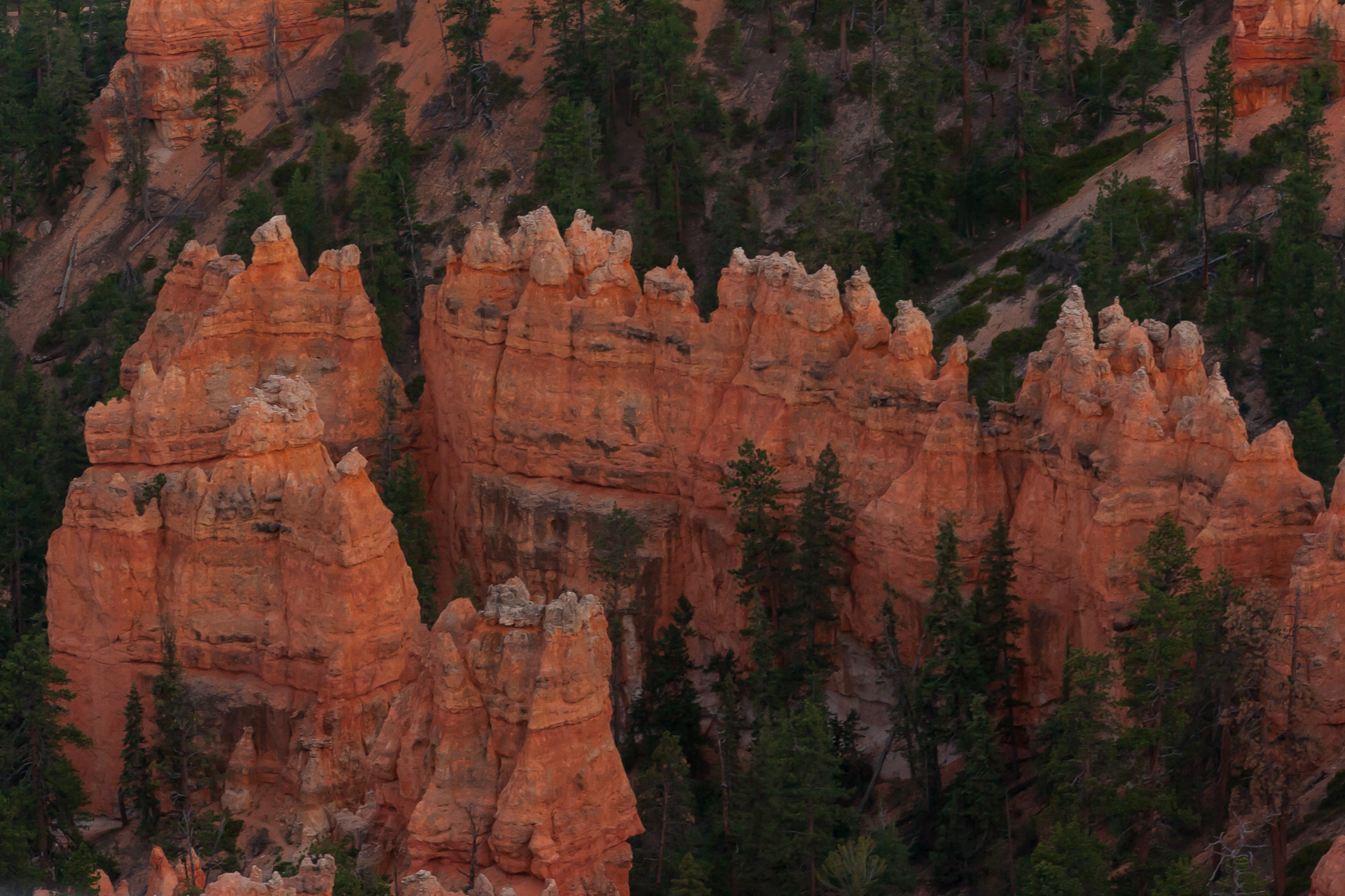
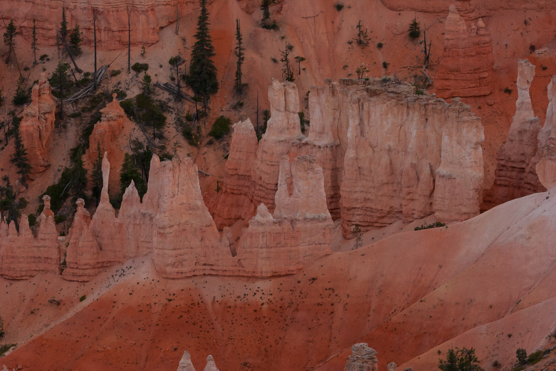
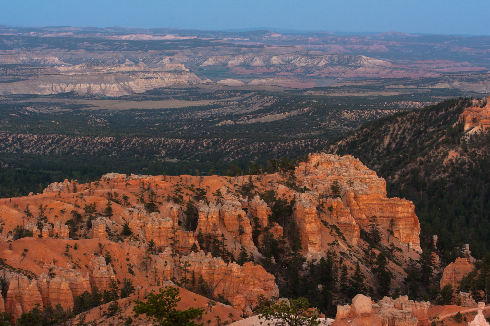
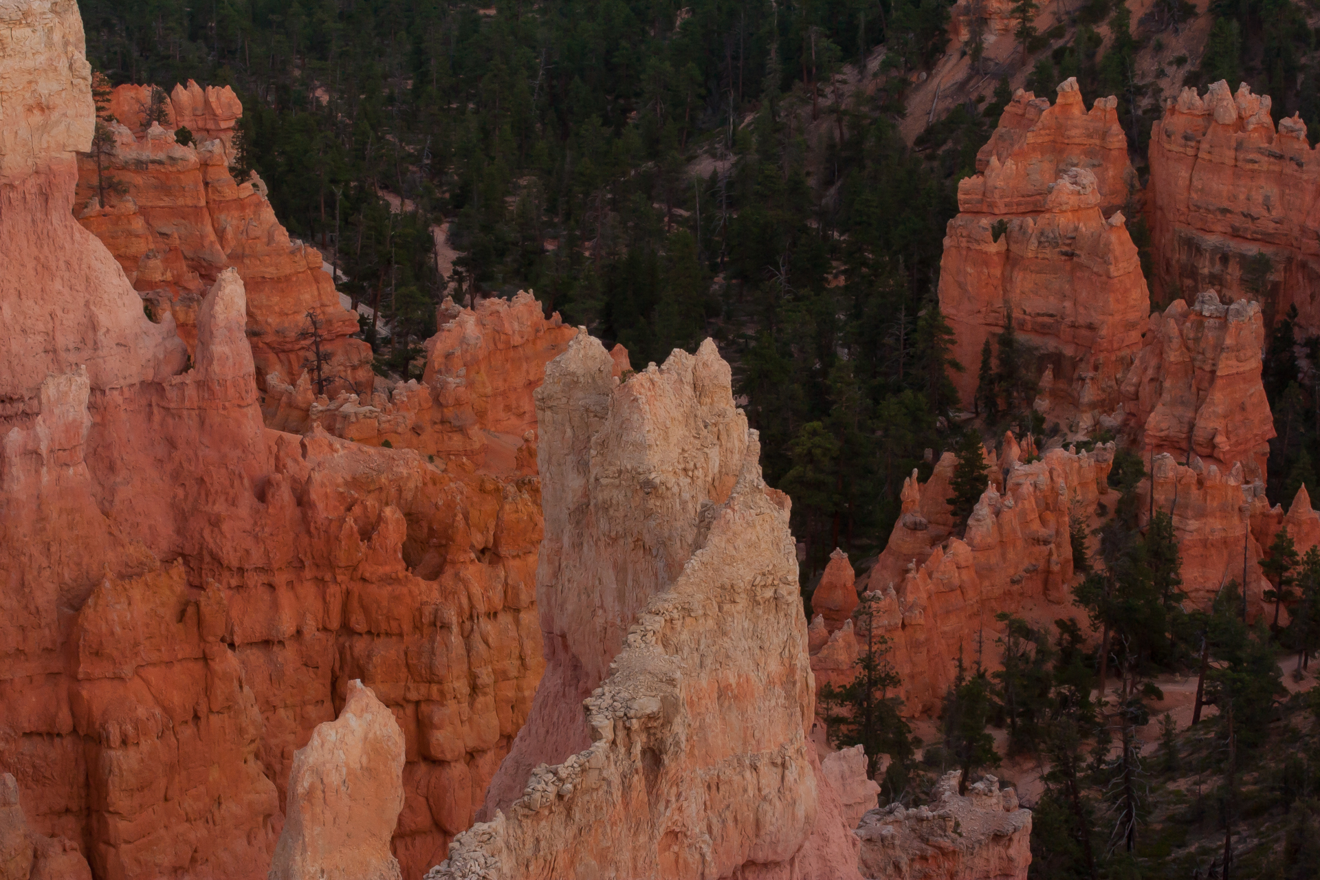
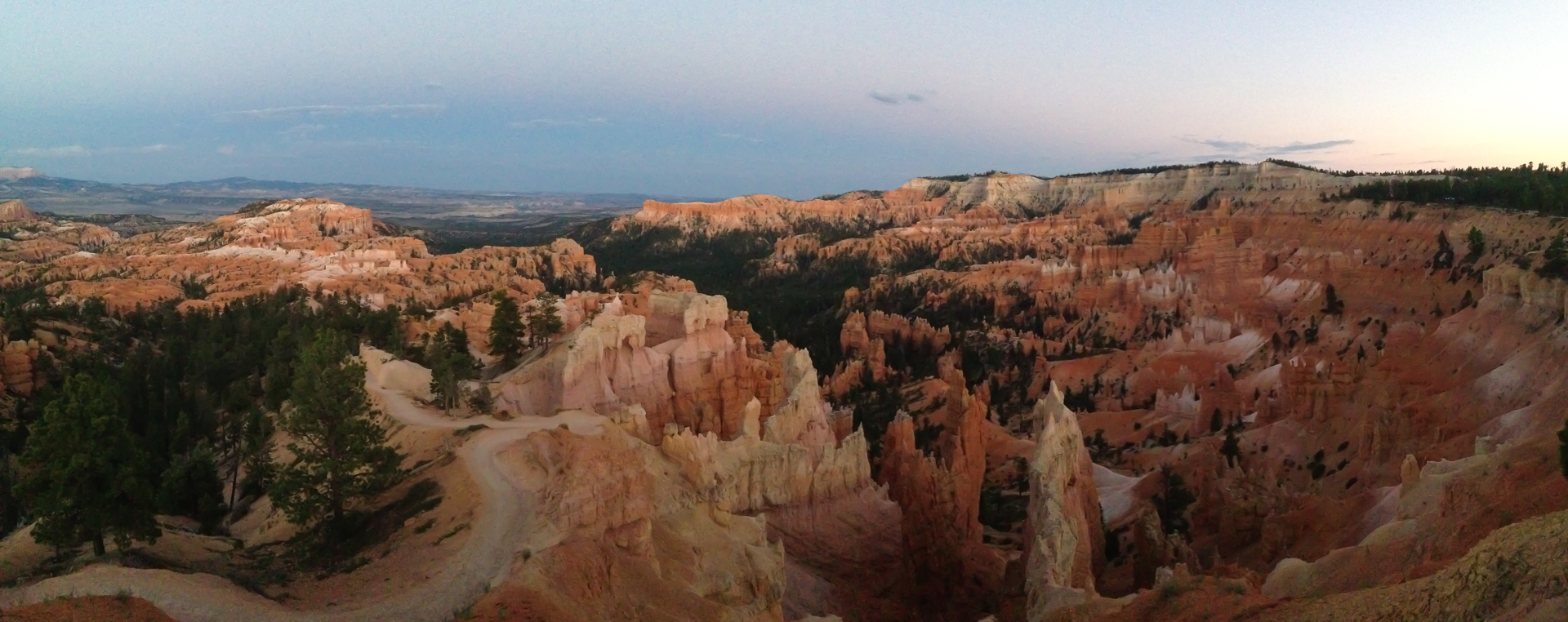
I made it to the Bryce Amphitheater in Bryce Canyon National Park just in time for sunset, and took the opportunity to walk the Rim Trail and take some pictures. Unfortunately, as it was quickly becoming dark, I didn't have time to go on any of the hiking trails or explore the rest of the park. I contemplated spending another day in Panguitch and going on a horseback tour of Bryce Canyon, but ultimately opted to leave for Zion National Park the next morning so that I'd have more time there.


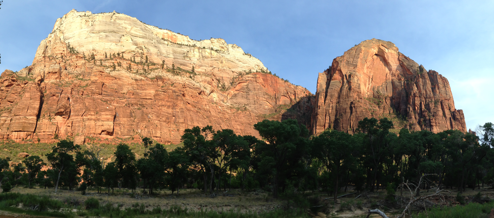
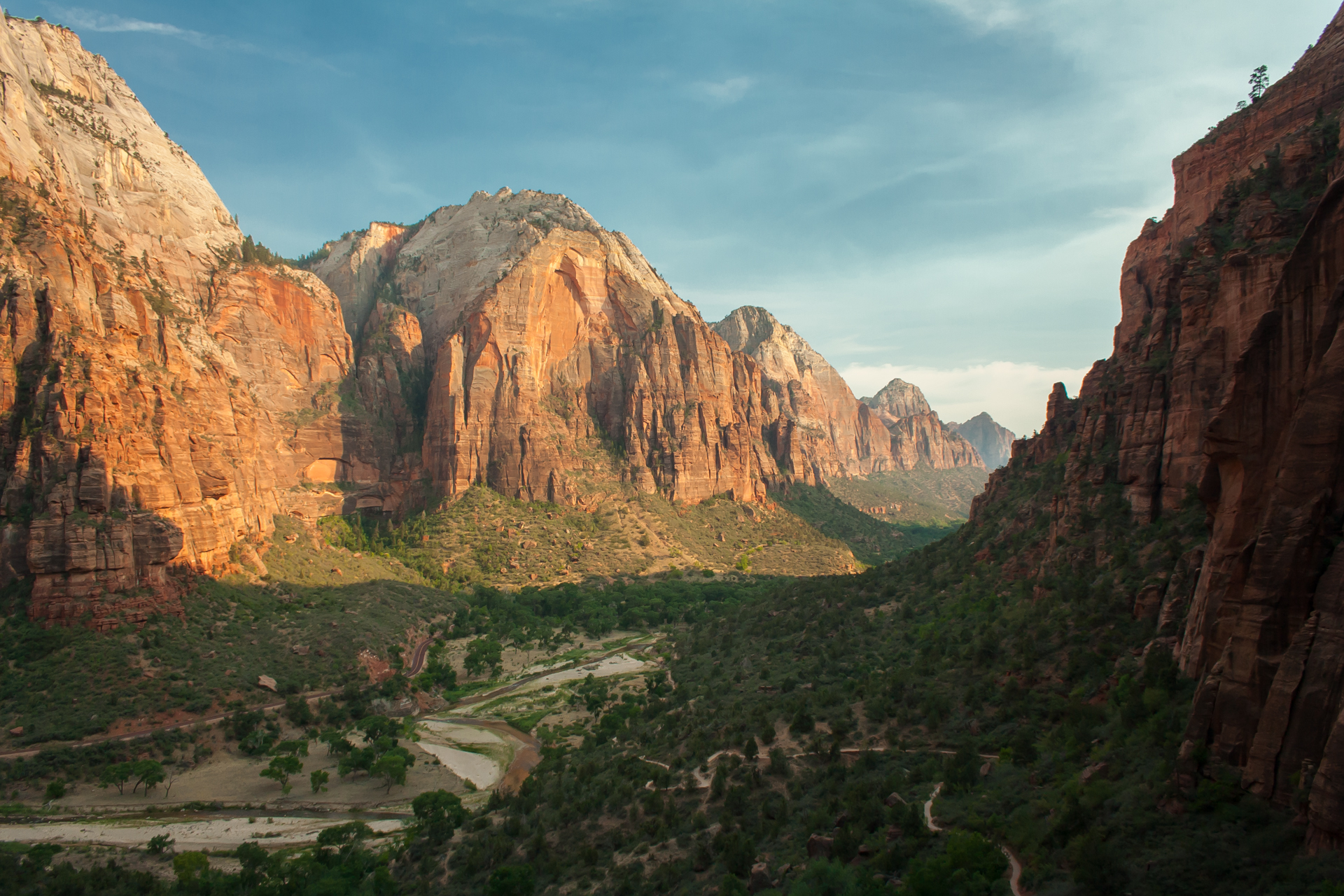
The next morning I made the 70-mile drive to Zion National Park. When I arrived, I immediately knew that I'd made the right choice in prioritizing Zion over another day at Bryce Canyon. The descent into the canyon from the eastern entrance is nothing short of spectacular. The Checkerboard Mesa is the first sight to greet visitors entering from the east, and it alone is a pretty remarkable formation, but it offers only the faintest hint at what awaits.
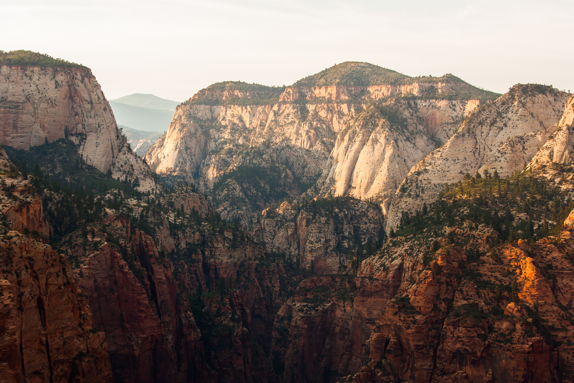
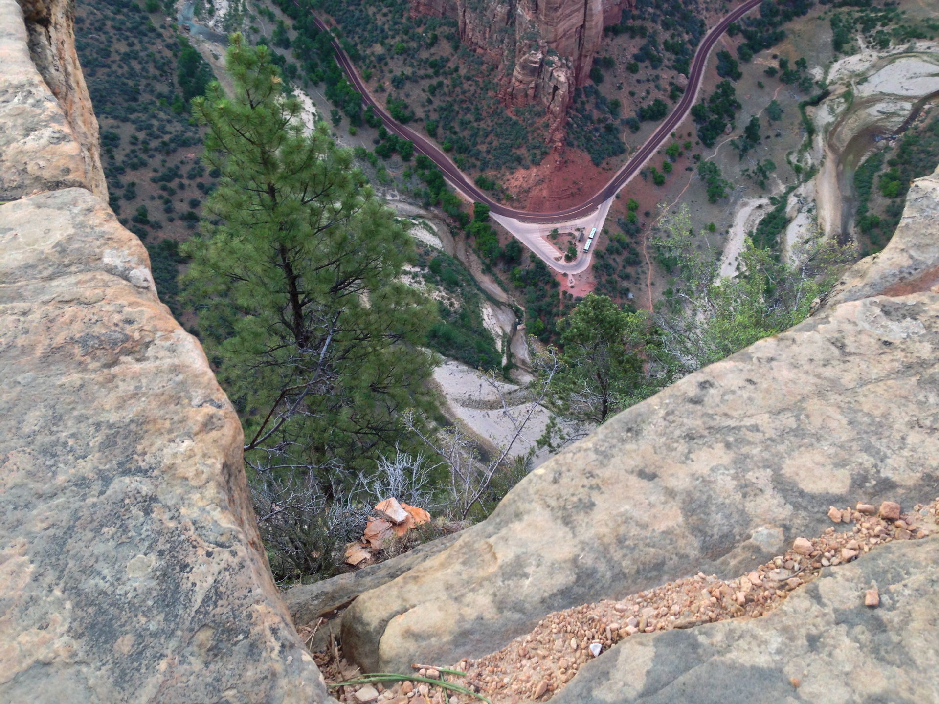
Walls of red stone rise up on either side as the road continues its descent into the Zion-Mt. Carmel tunnel. The long, narrow tunnel was carved right into the side of the canyon between during the years of 1927 to 1930. Occasional openings in the side of the tunnel offer glimpses of the valley below, but the sight when one finally emerges on the other side is truly breathtaking. It reminded me of the descent into Yosemite Valley, but with towering walls of red sandstone instead of granite. As impressive as the drive is, though, it doesn't even pass through Zion Canyon proper.
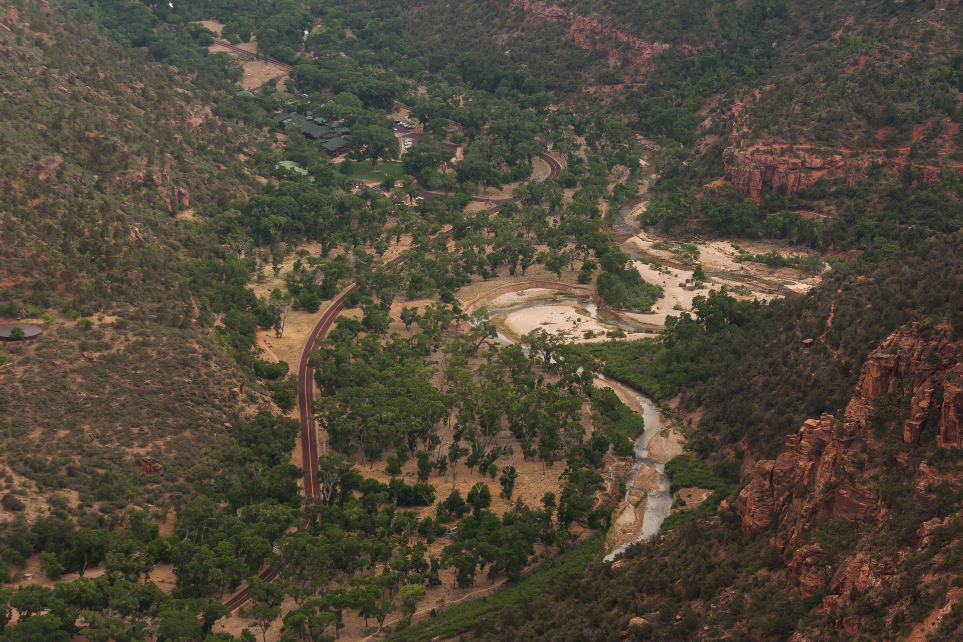
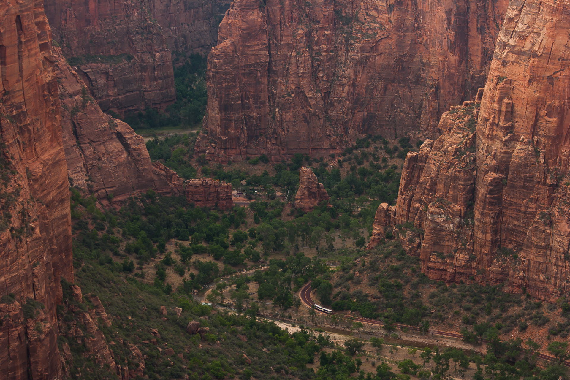
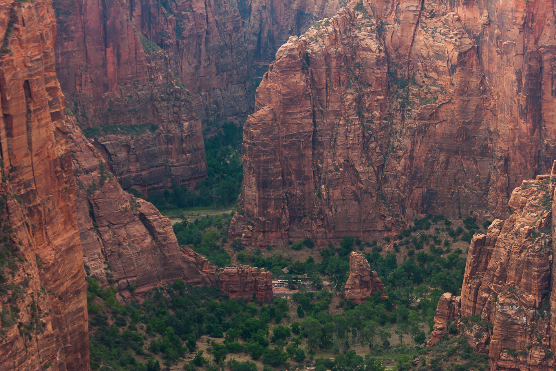
I checked into my campground, set up my tent, and planned for my first hike: Angels Landing. It was still early in the afternoon, and far too hot for a 5 mile (8km) hike with around 1500 feet (460m) of elevation gain. Luckily, my campground was also an RV park and inn, so it had amenities such as a pool and showers. I lounged around the pool until later in the afternoon when the temperature started to drop, and then, carrying my tripod, camera, and an ample supply of water, hopped on the canyon bus.
Due to the limited area of the canyon, and to reduce environmental impact, visitors aren't allowed to drive or park in Zion Canyon itself. Instead, the park operates a free shuttle bus up and down the canyon, complete with narration describing the history of the canyon and the significance of each of location it stops at. While informative, the narration gets a bit tiring after the third or fourth time you hear it, which makes one feel sorry for the park staff who are subjected to it daily. On the first bus I took, a woman who I assumed to be an off-duty park employee entertained us by reciting word for word, but in a very sarcastic tone, several minutes of the narration.
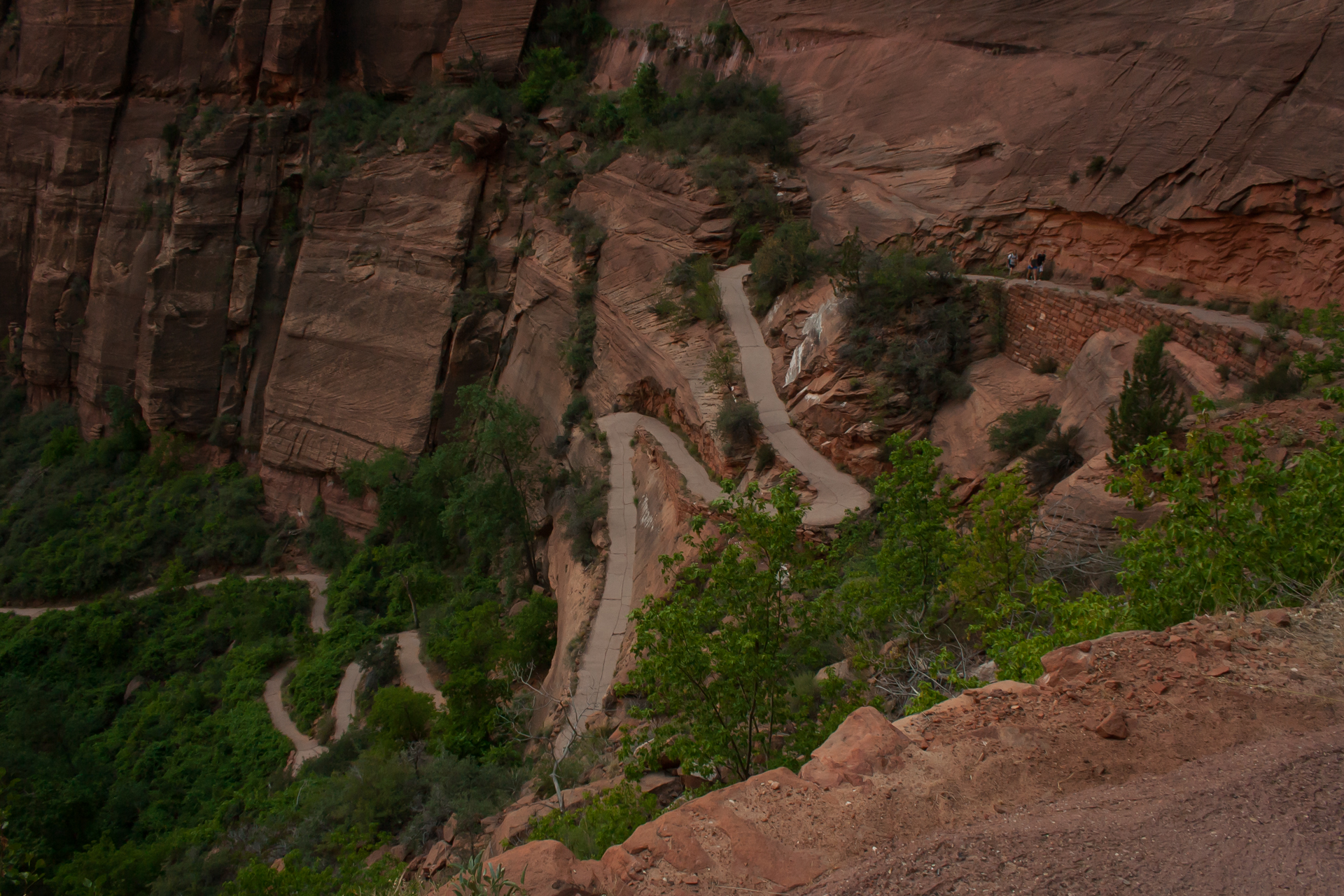
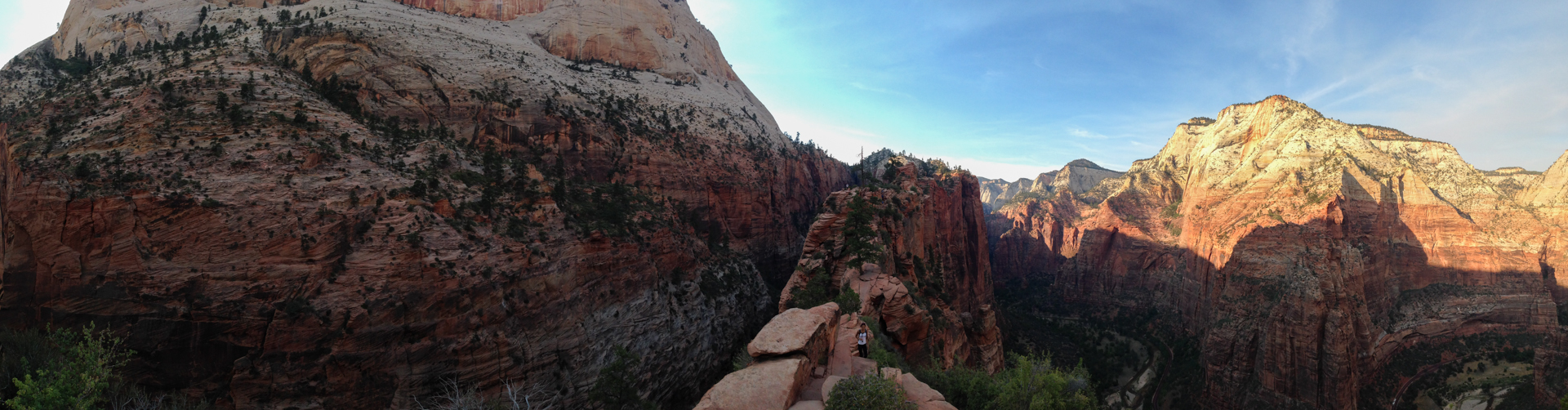
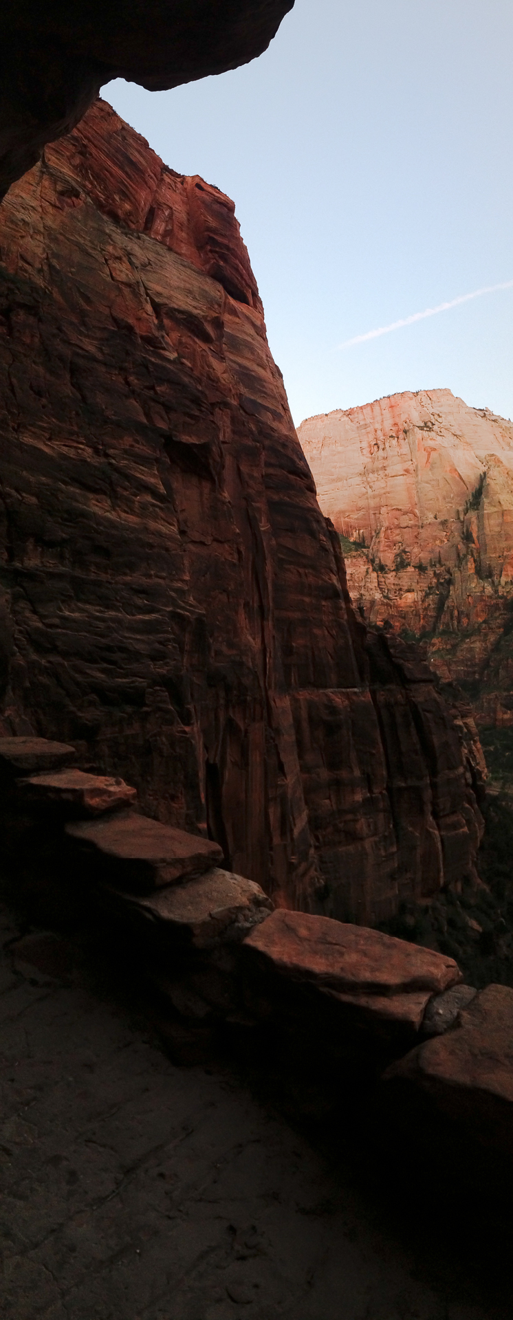
The climb up to Angels Landing starts off with a deceptively gentle walk along the Virgin River at the bottom of the canyon, but then quickly climbs upward along a series of increasingly steep switchbacks. It was still hot enough out to make the upward trek thoroughly exhausting. Thankfully, the aptly named Refrigerator Canyon offered some respite. Encountered about half way through the hike, the small box canyon is consistently several degrees cooler than ambient temperatures.
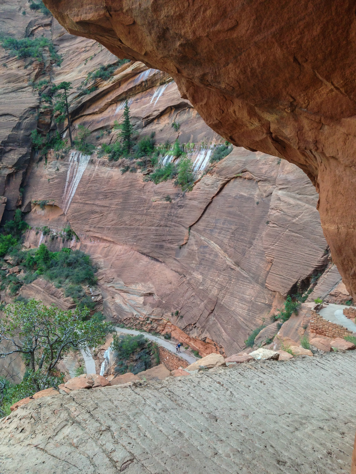
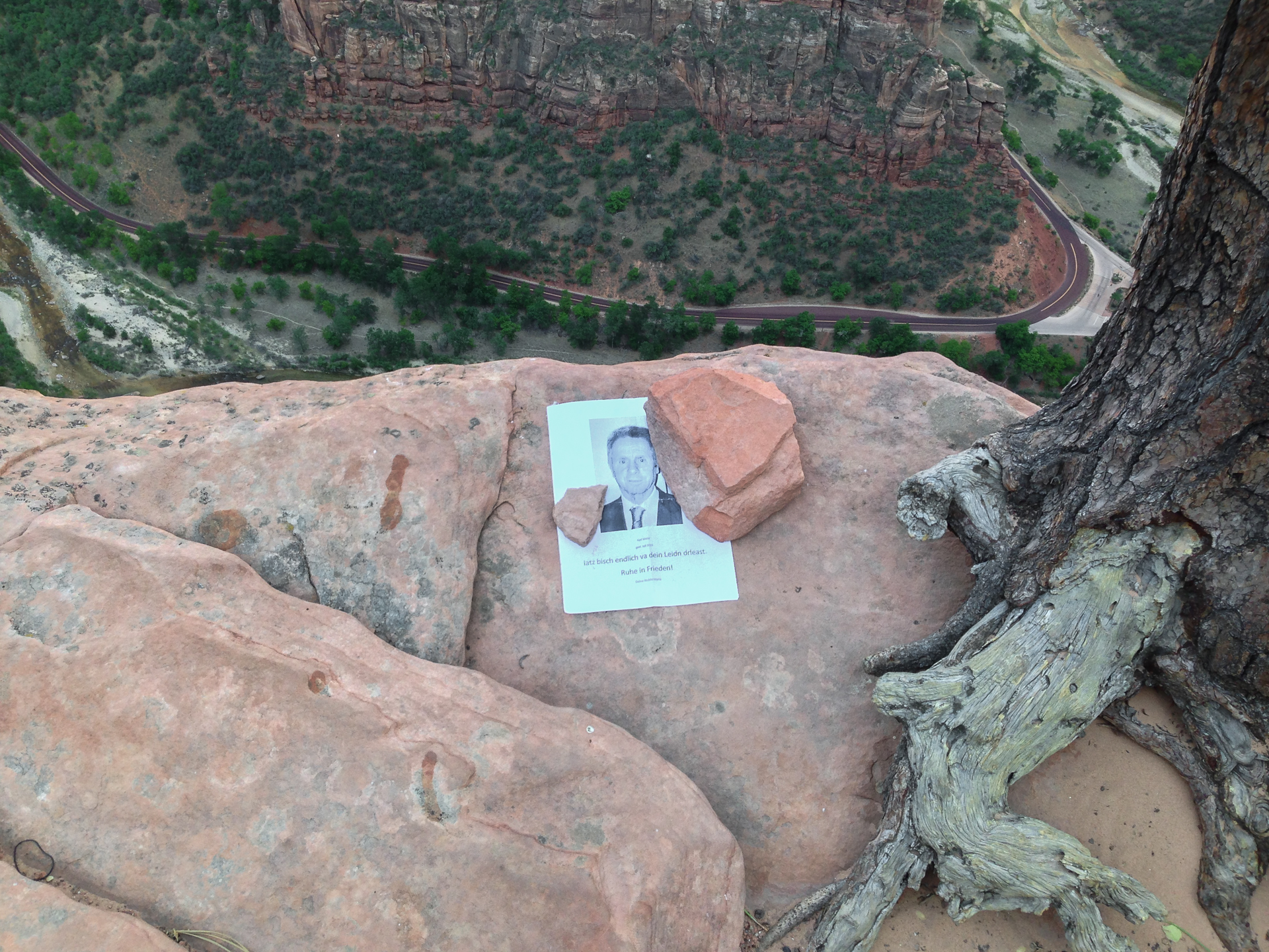
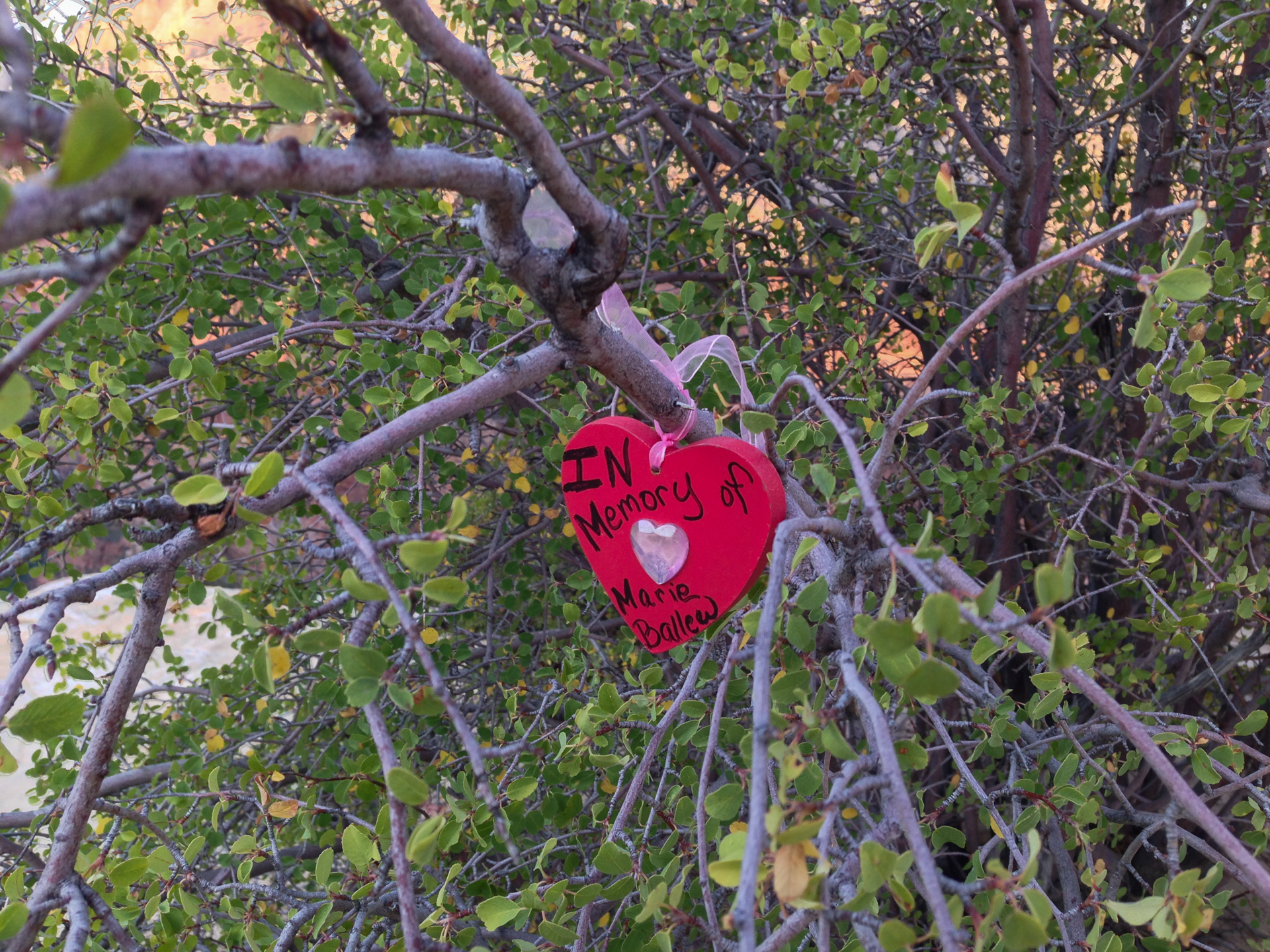
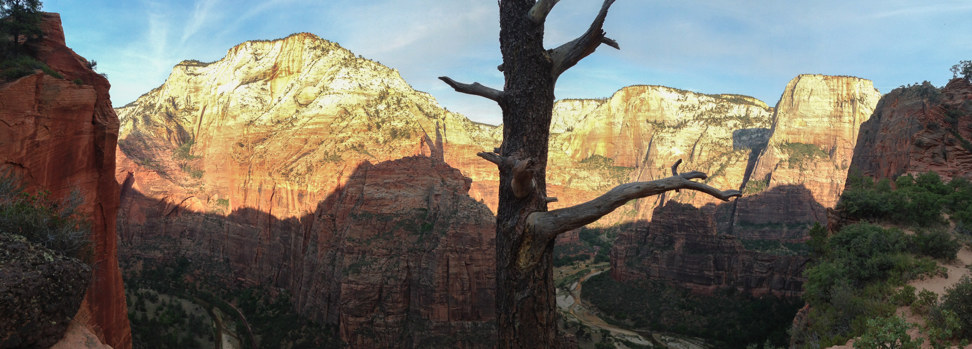
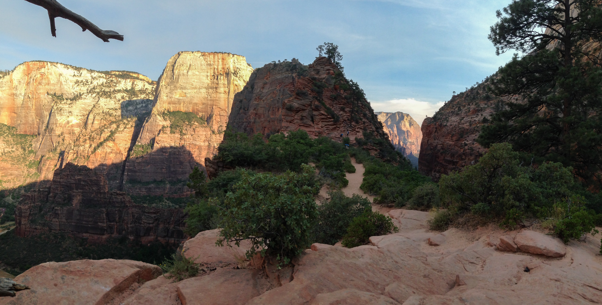
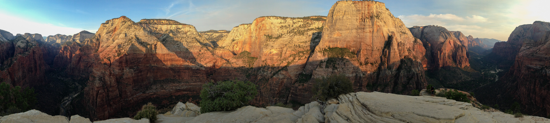
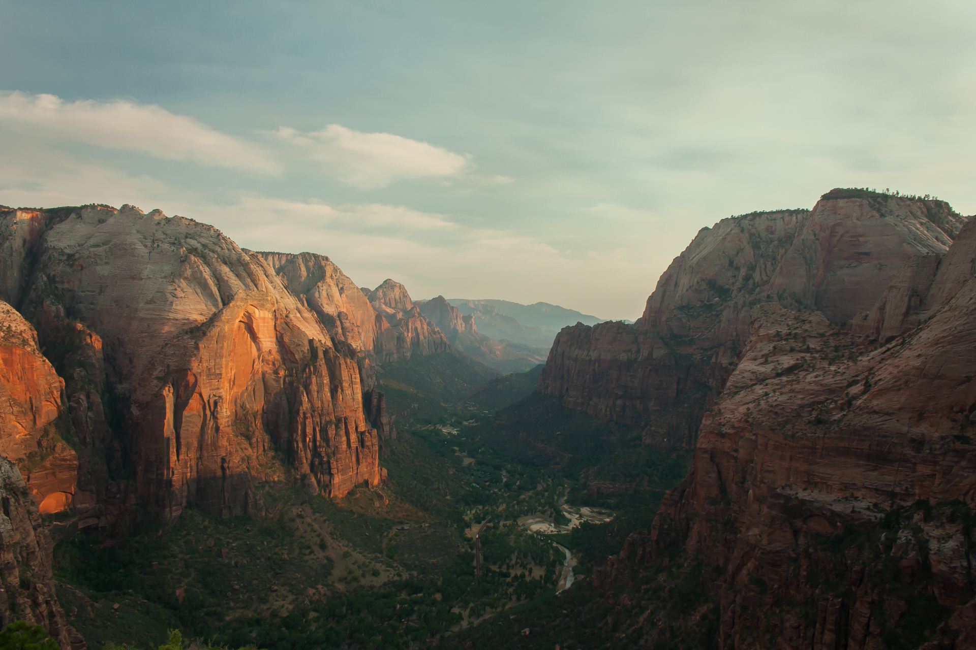
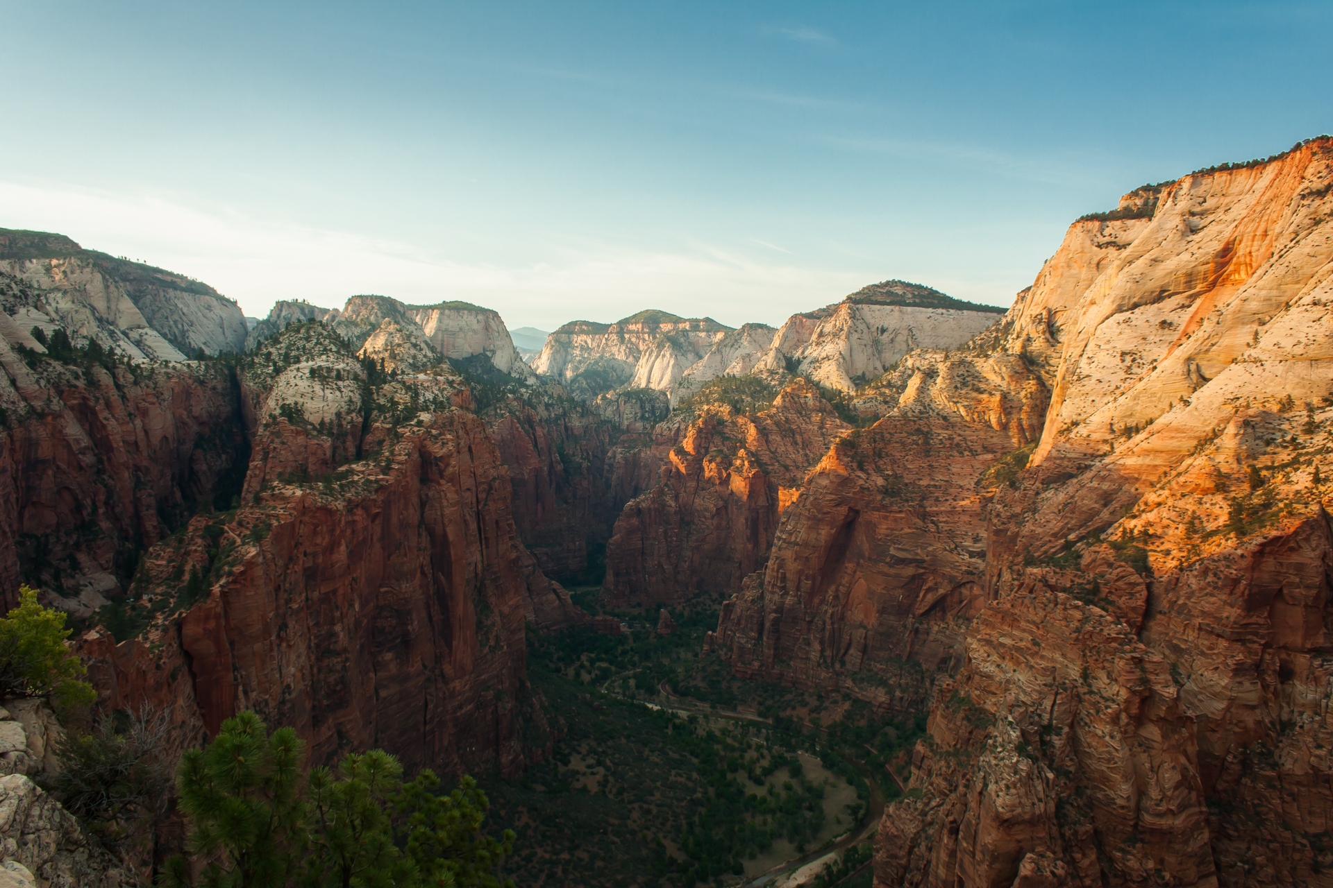
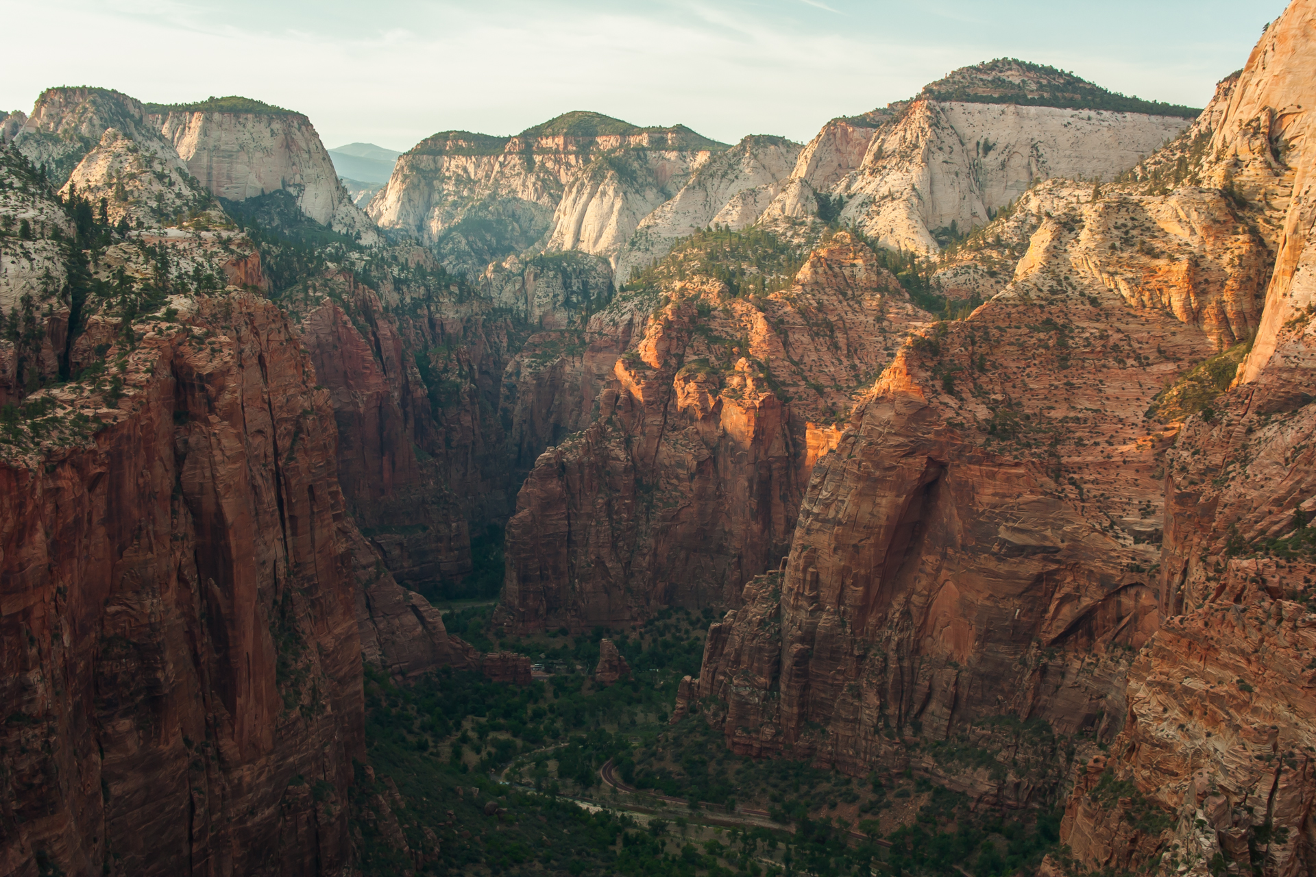
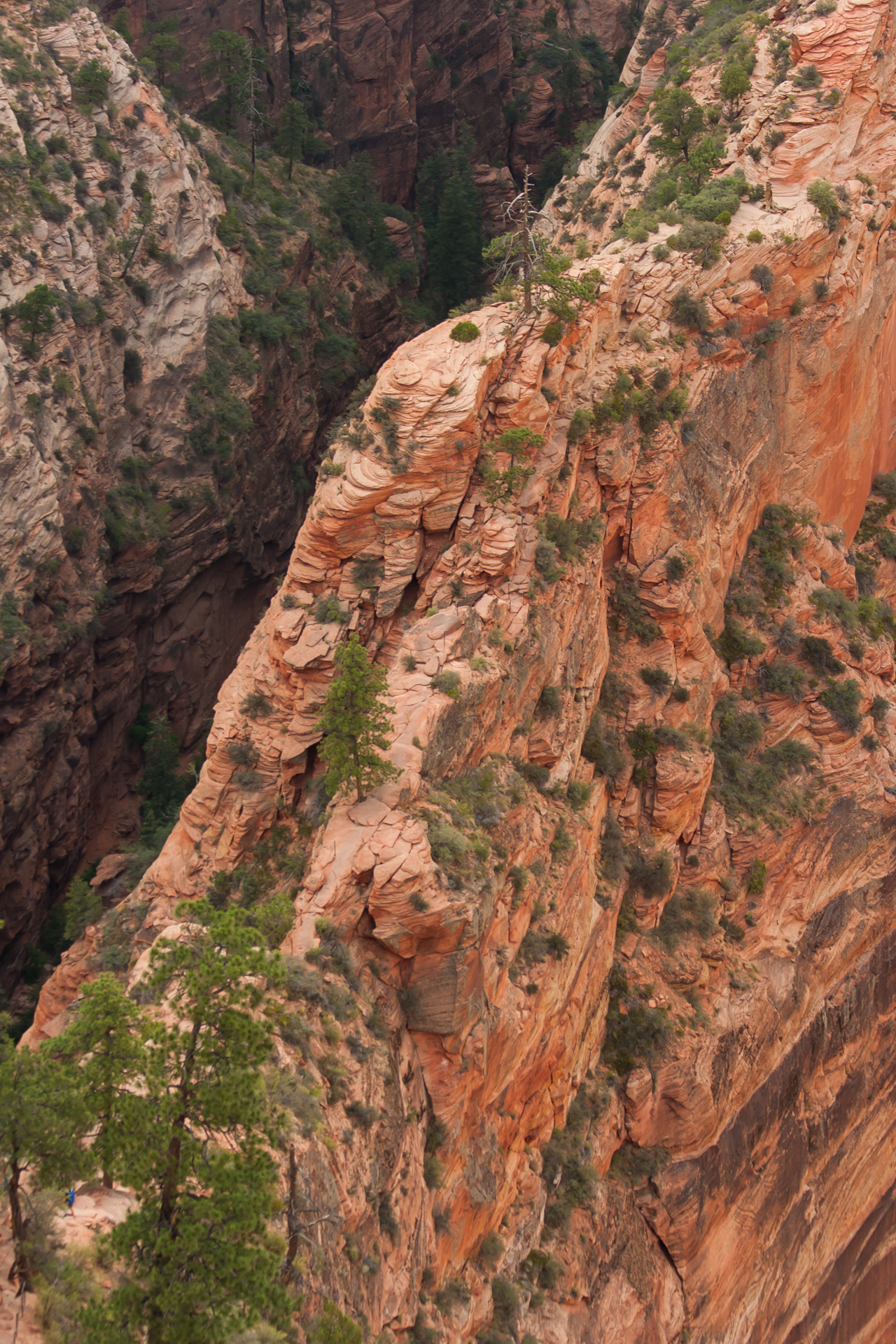
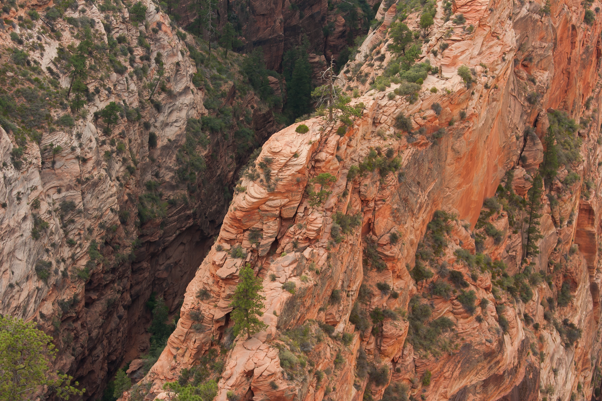
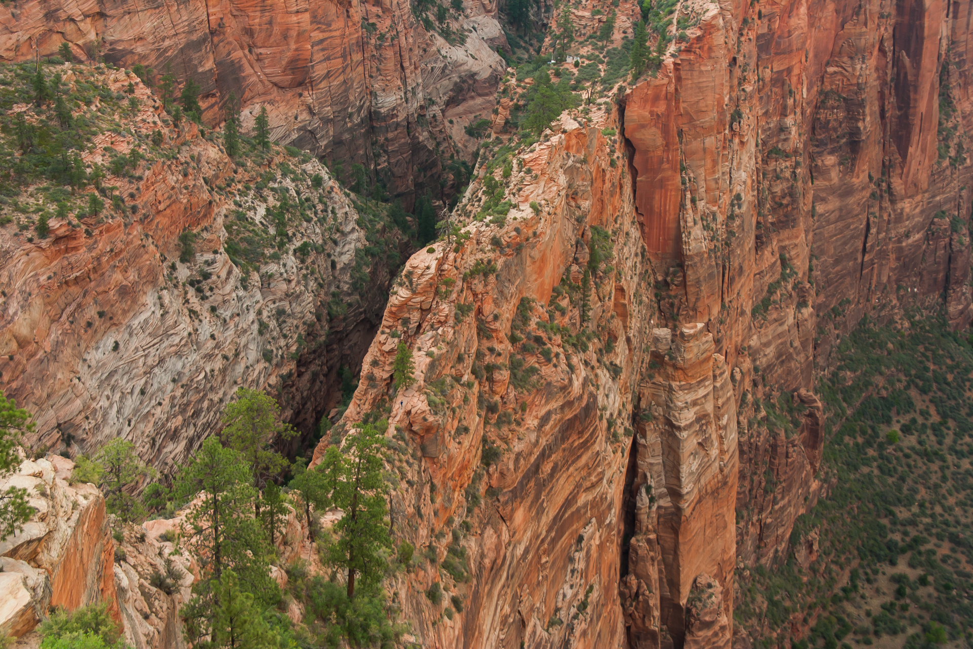
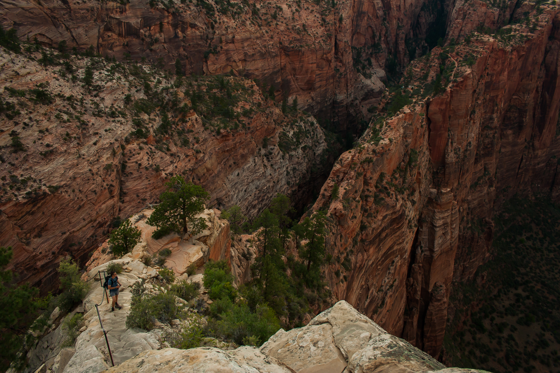
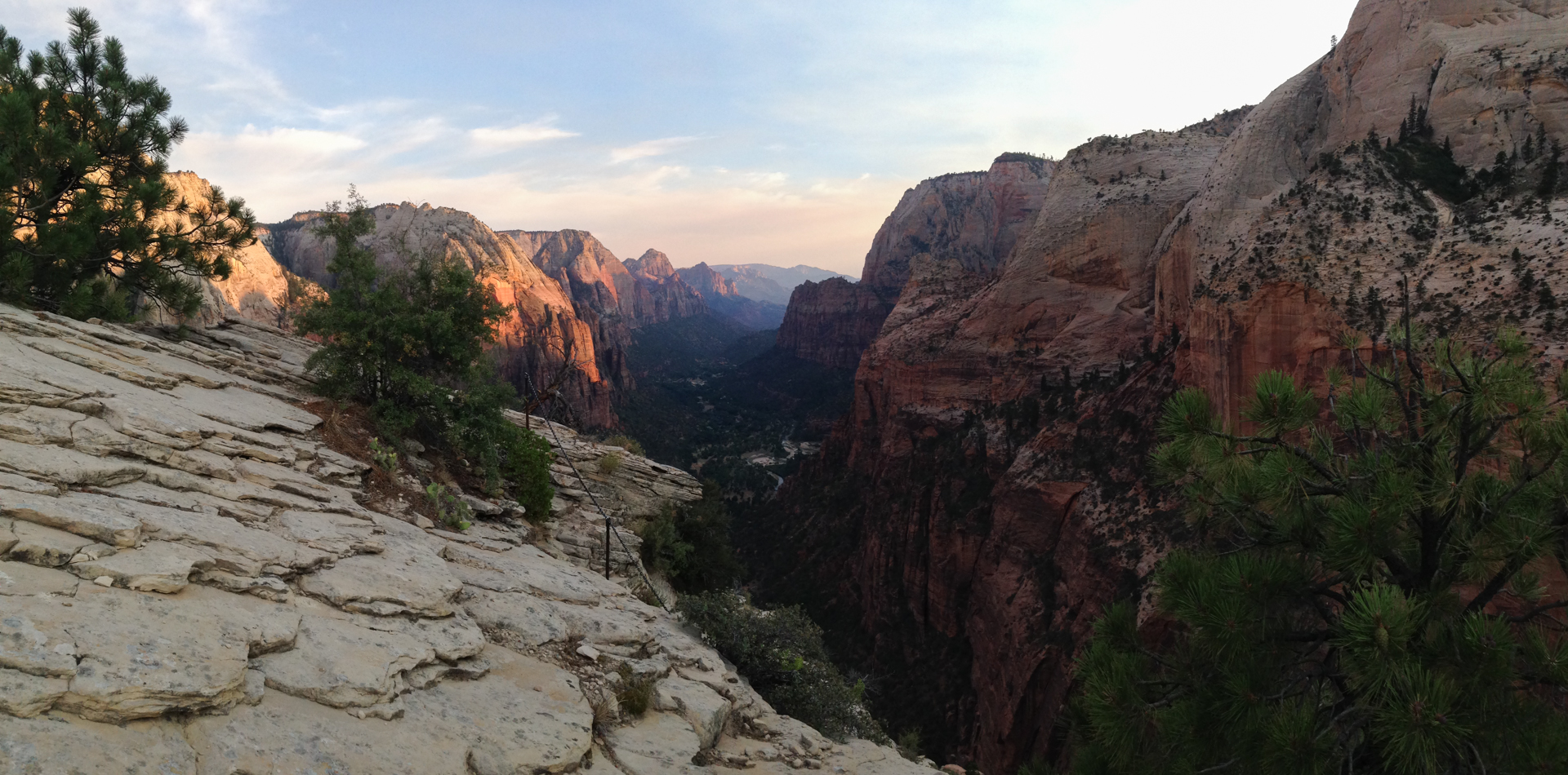
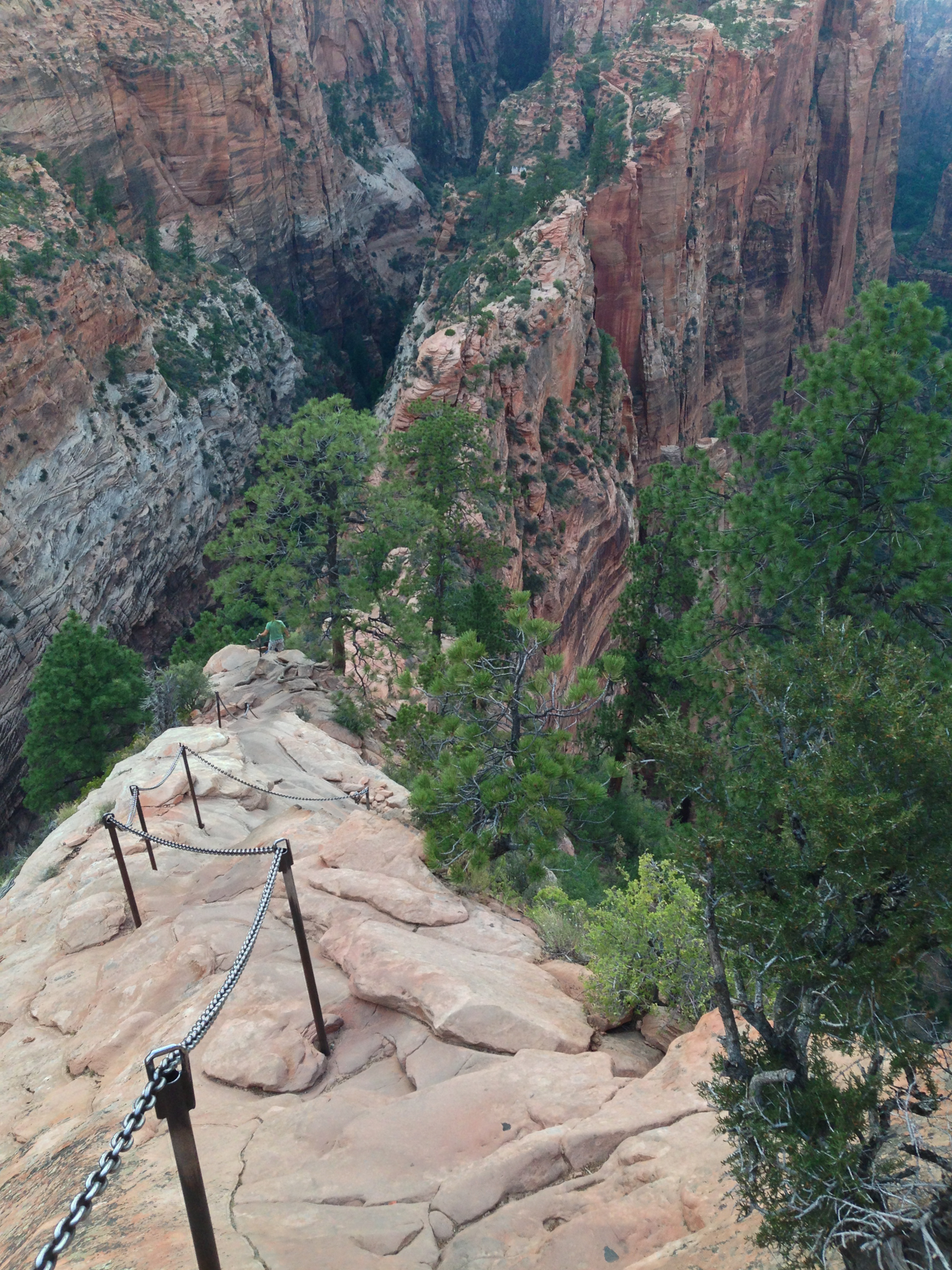
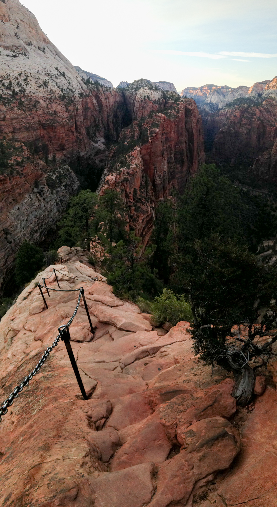
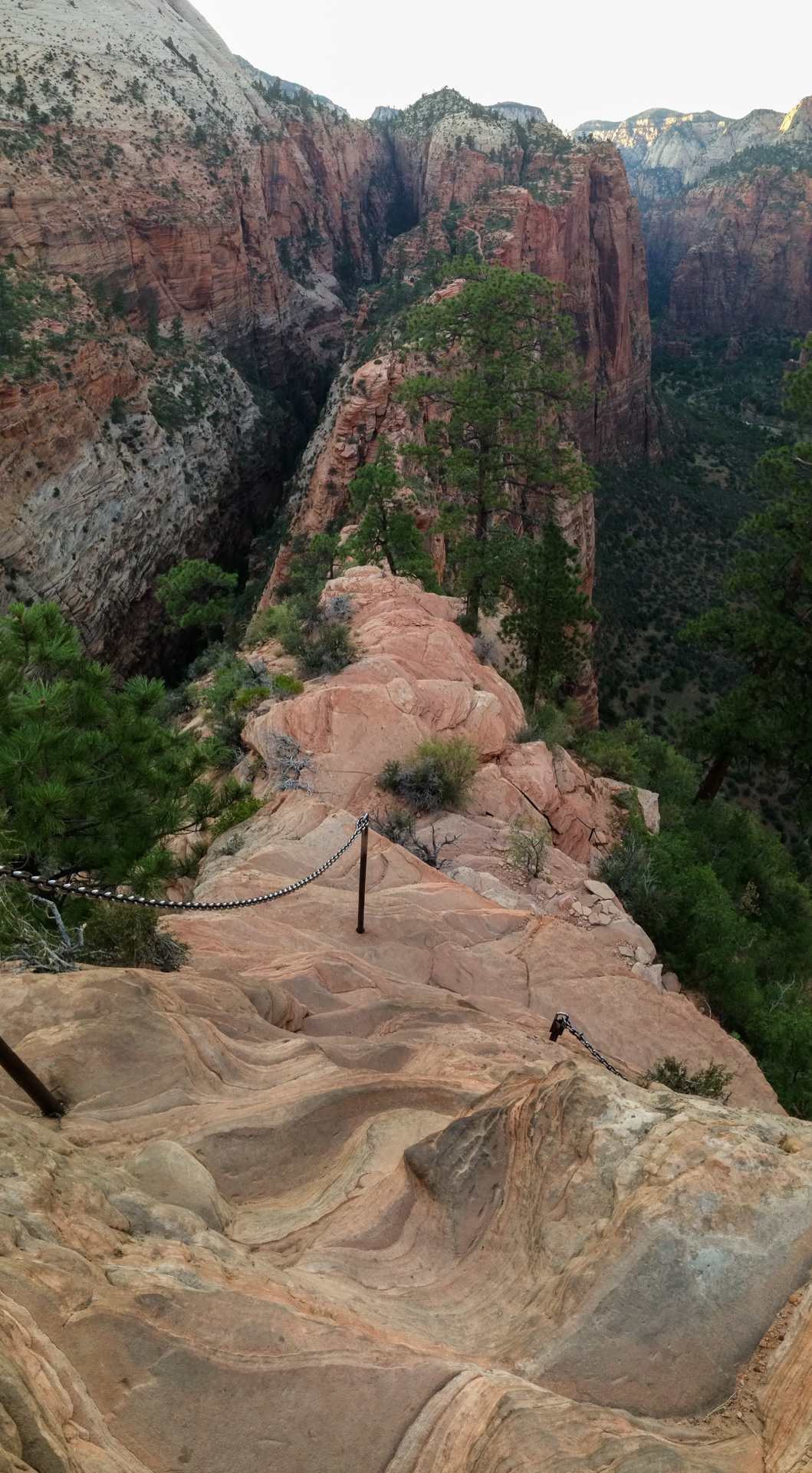
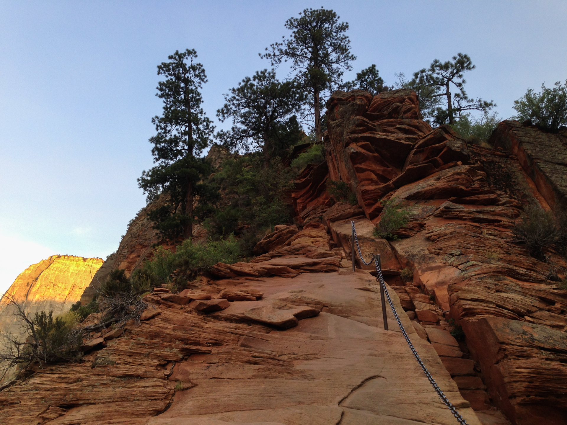
At the end of Refrigerator Canyon, the trail ascends Walter's Wiggles, a long set of tight, steep switchbacks, and then emerges atop a spine of cliff that culminates in Angels Landing itself. This is where the trail really gets fun—or terrifying, depending on your perspective. I don't consider myself to be particularly afraid of heights, but the view down to the valley floor is truly dizzying, even before one reaches the top of Angels Landing. And between the top of the of the Wiggles and the Landing, there are still hundreds of vertical feet to climb along a twisting, rocky, extremely narrow trail where a slip to either side means certain death. So steep is this section of trail that much of it is spent pulling oneself upward along sections of chain that the National Park Service has anchored into the rock. It's remarkable that only a handful of people have died at Angels Landing. Did I mention that I was carrying a tripod and several pounds of camera equipment the whole way up?
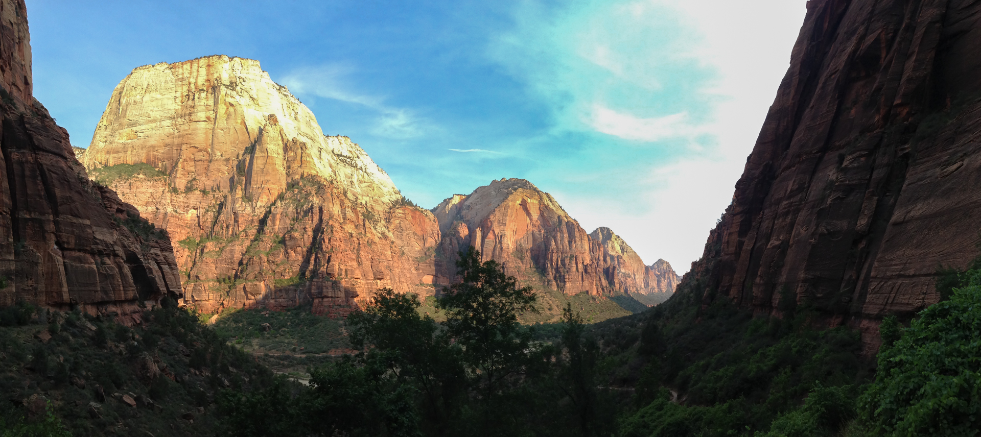
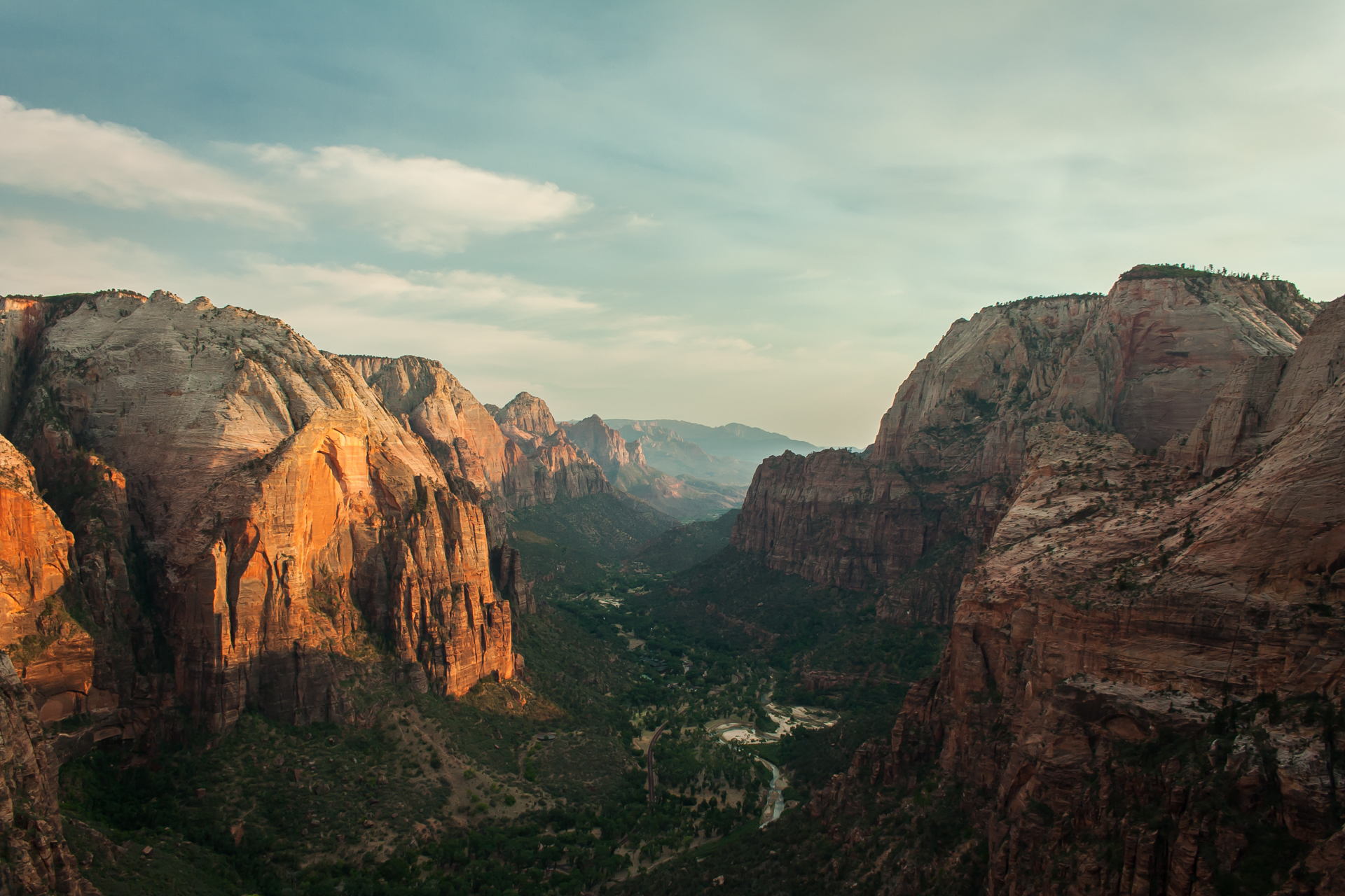
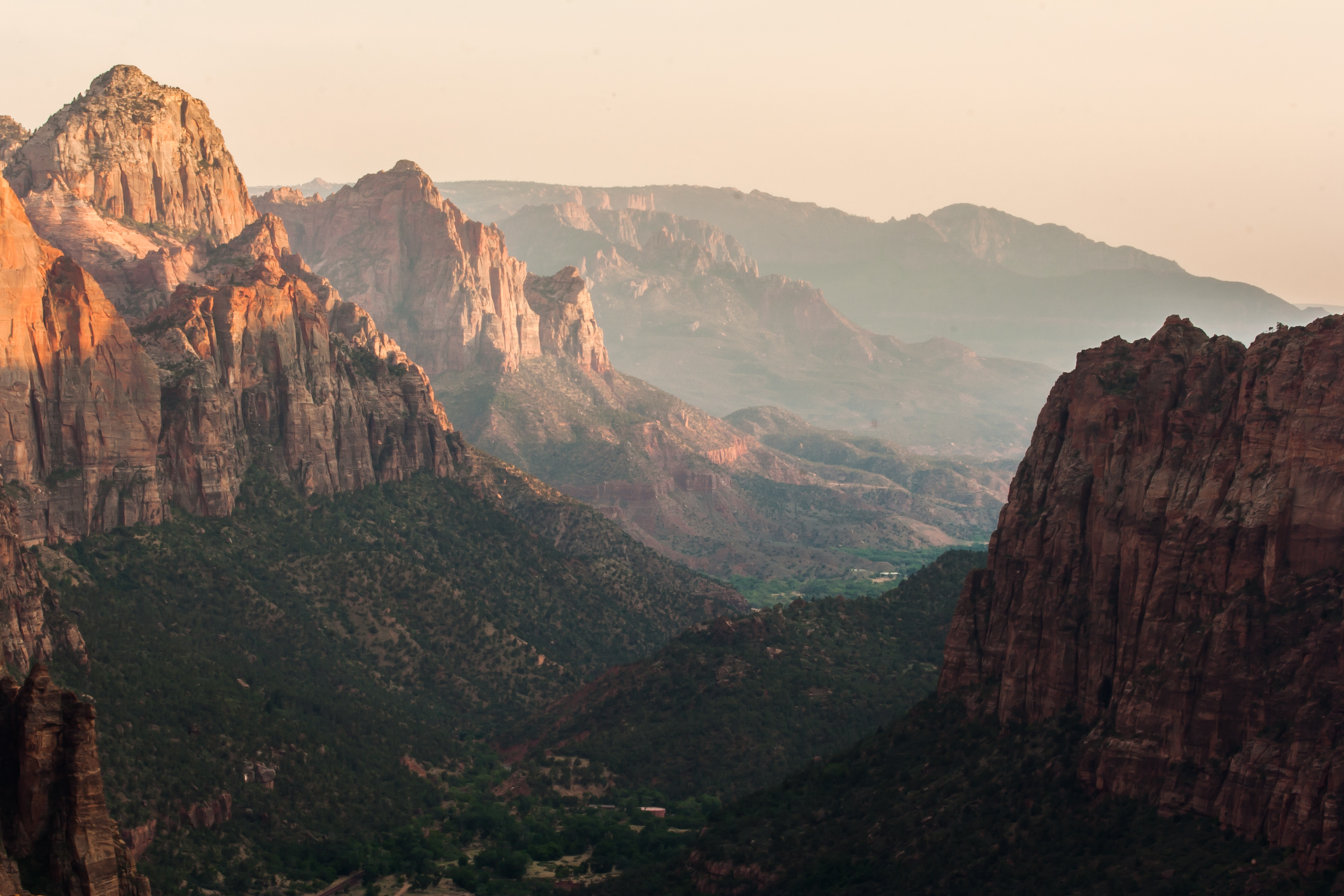
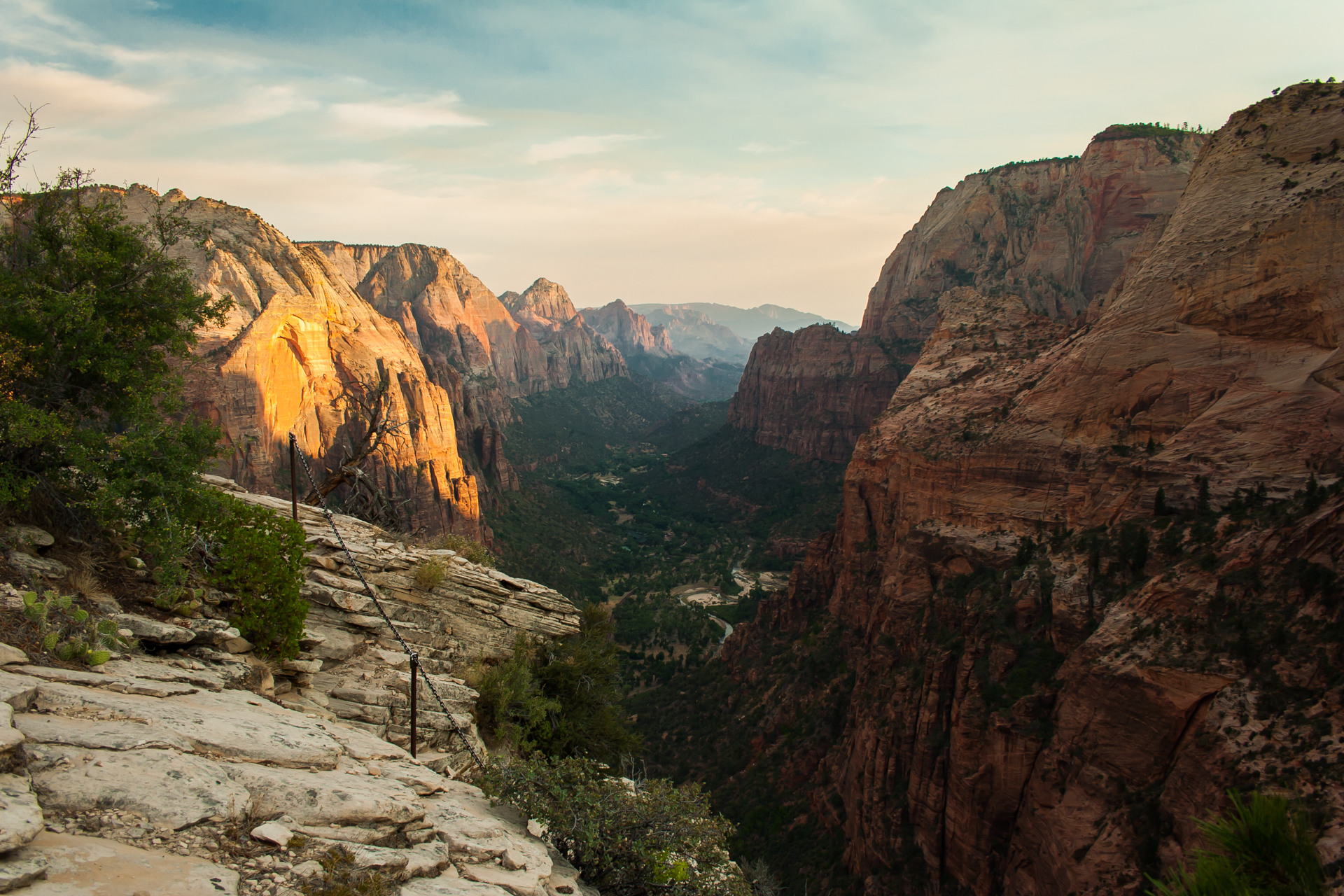
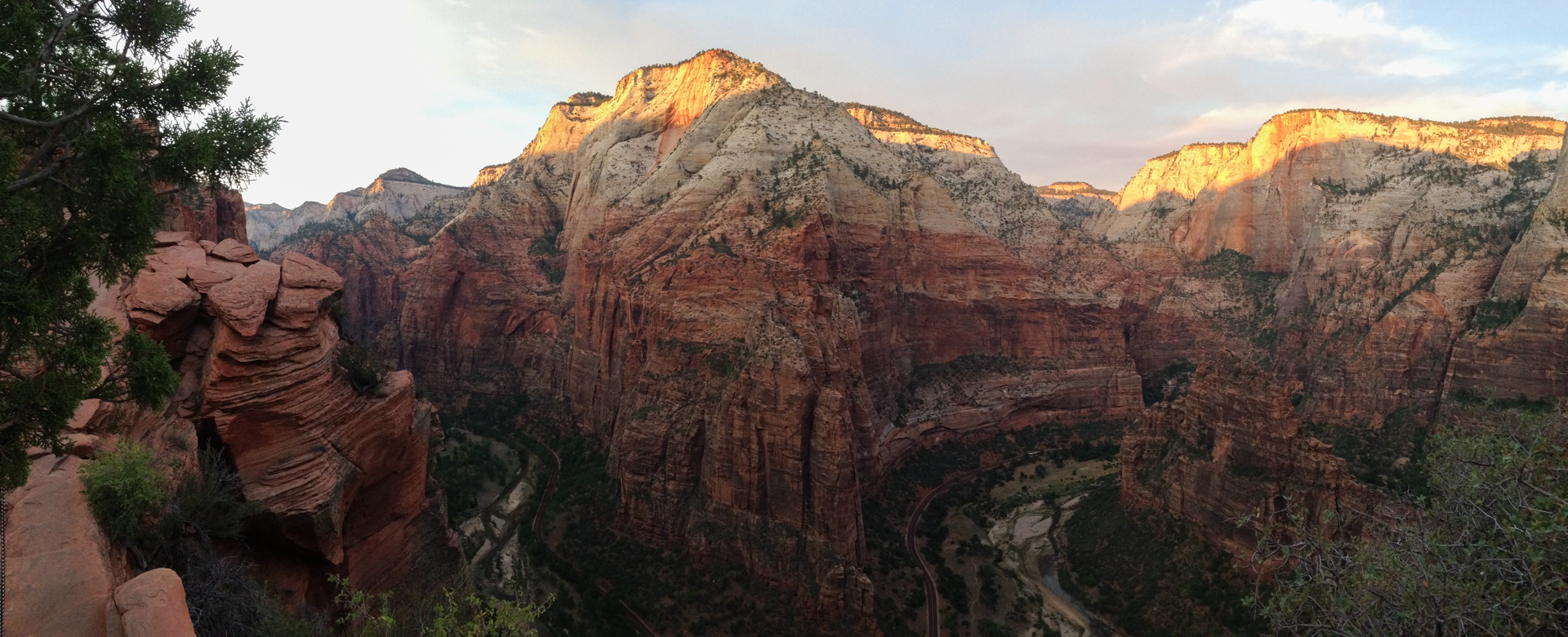
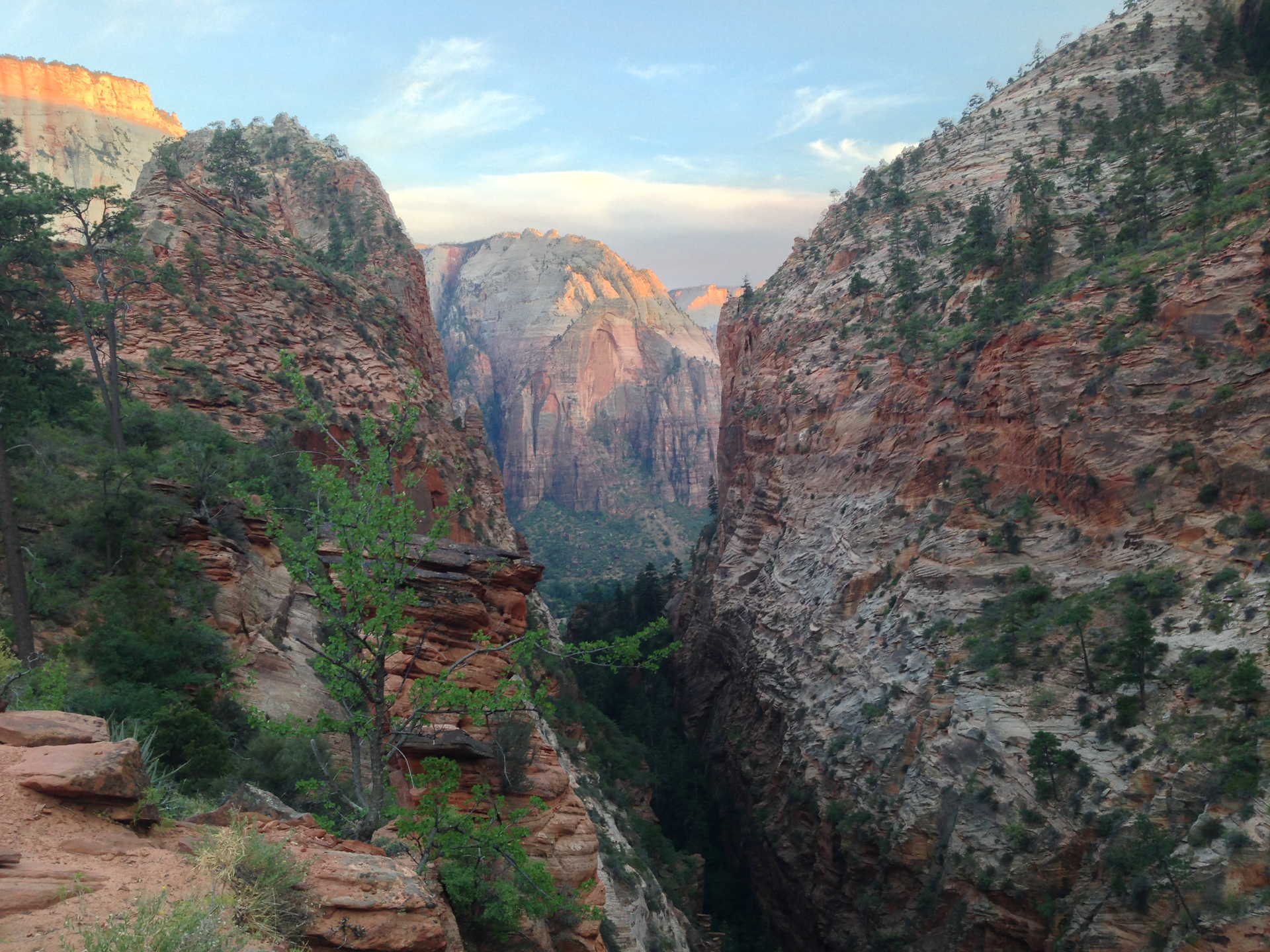
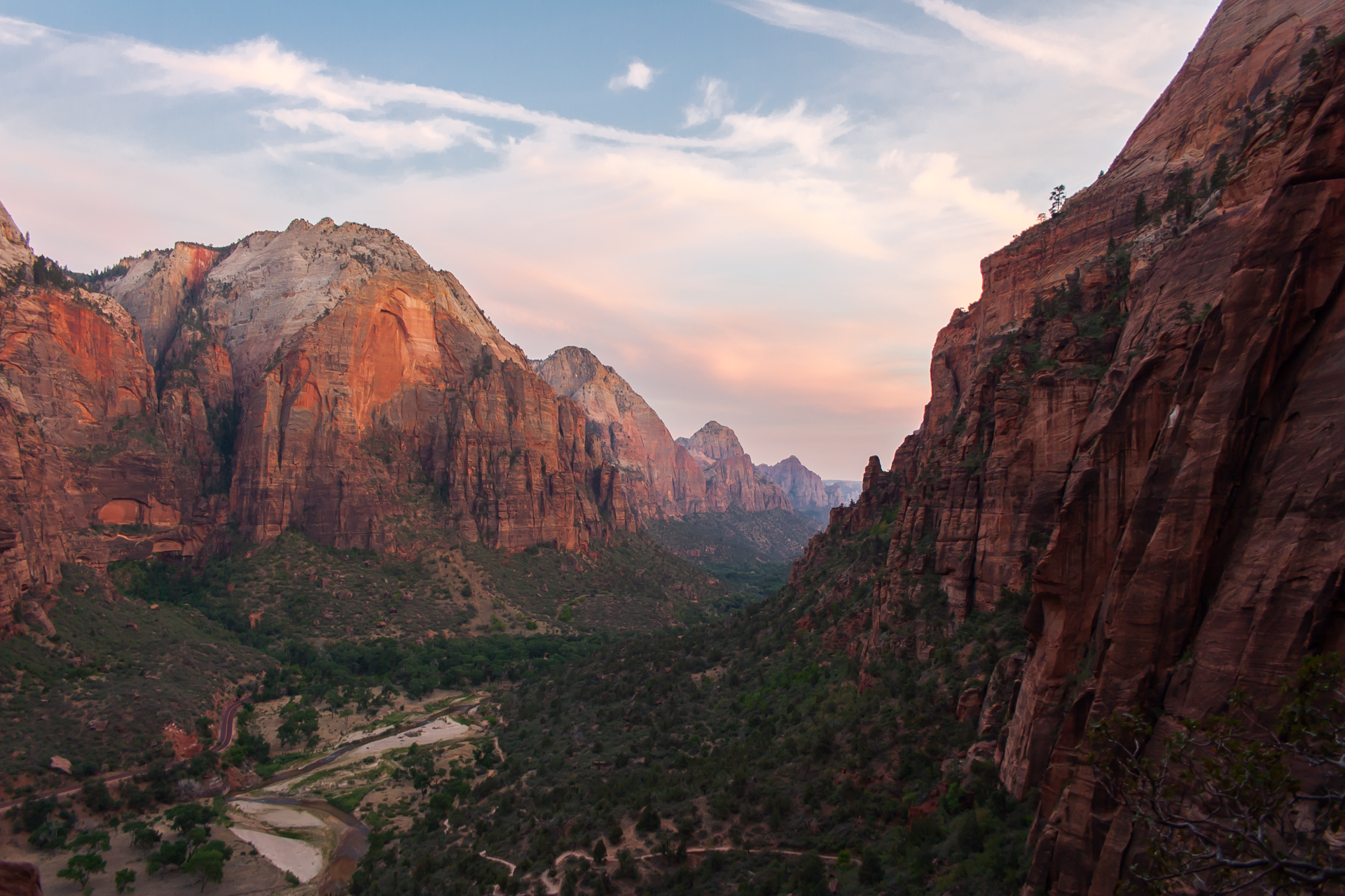
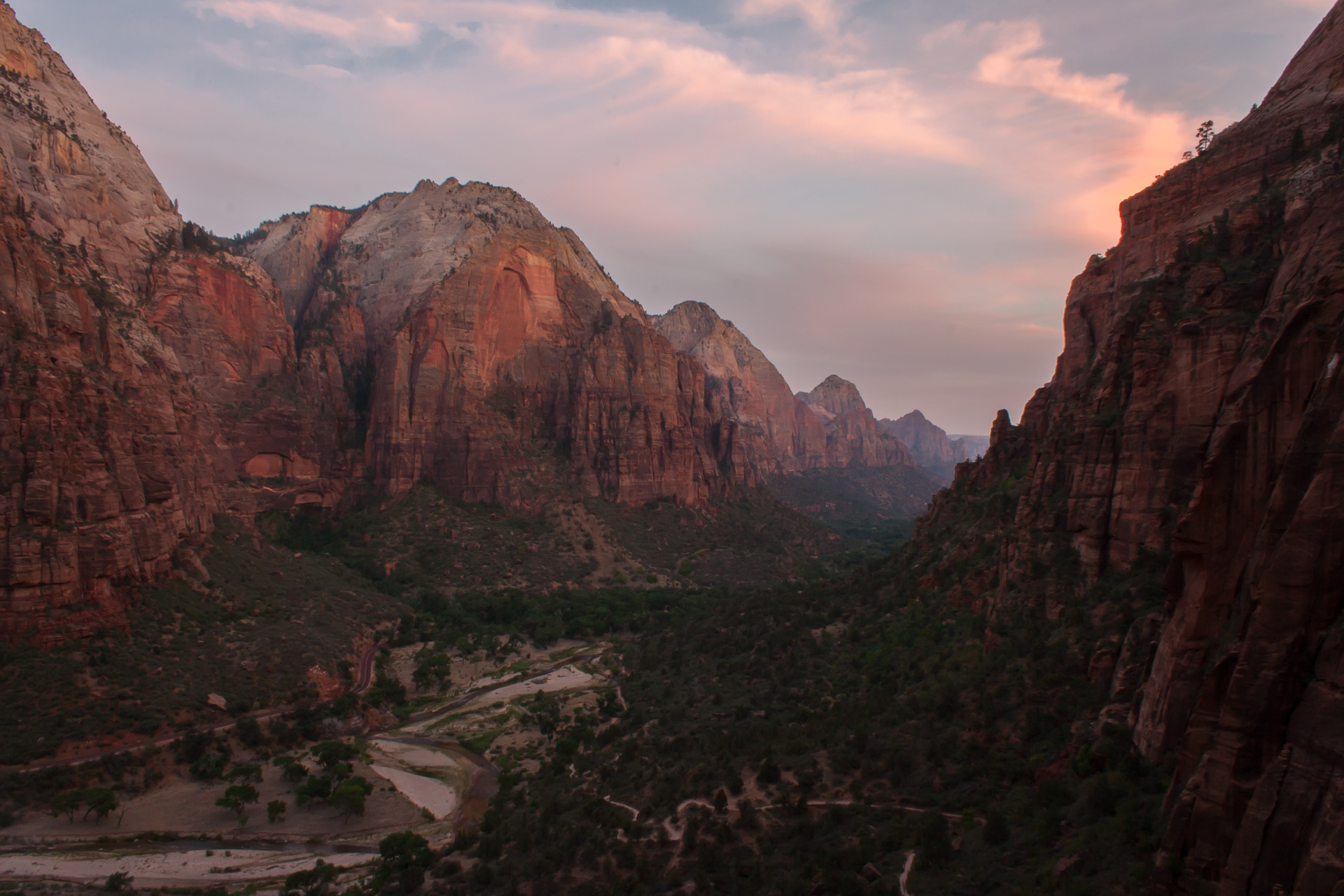
Arriving at the summit, though, the perilous hike proved to be more than worthwhile as I was afforded a beautiful view of Zion Canyon. The brilliant green foliage along the valley floor gives way to majestic orange cliffs, which turn fiery red as the sun sinks in the distance. Words can't do it justice, and frankly, neither can my photography, but I tried nevertheless:


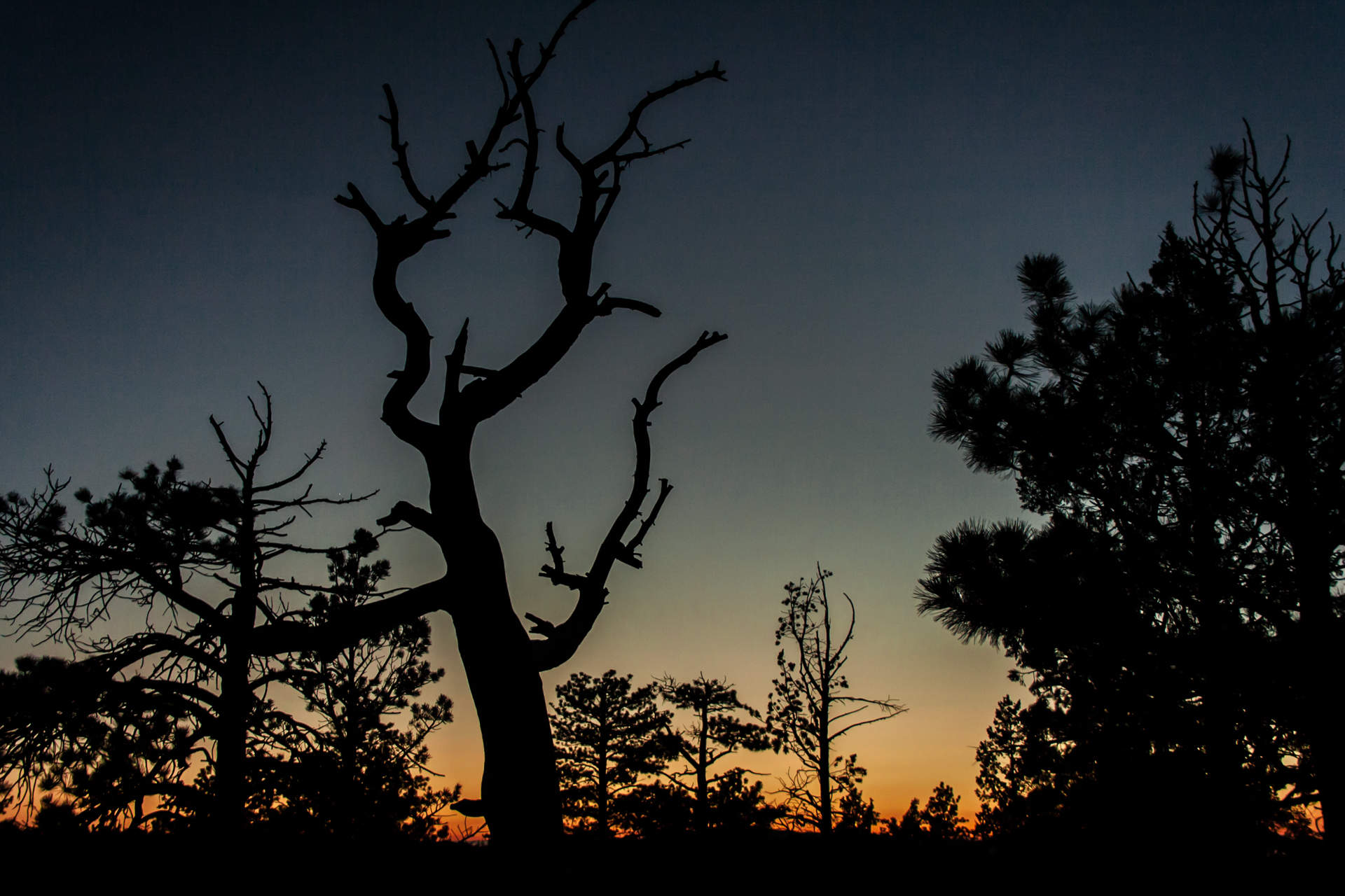
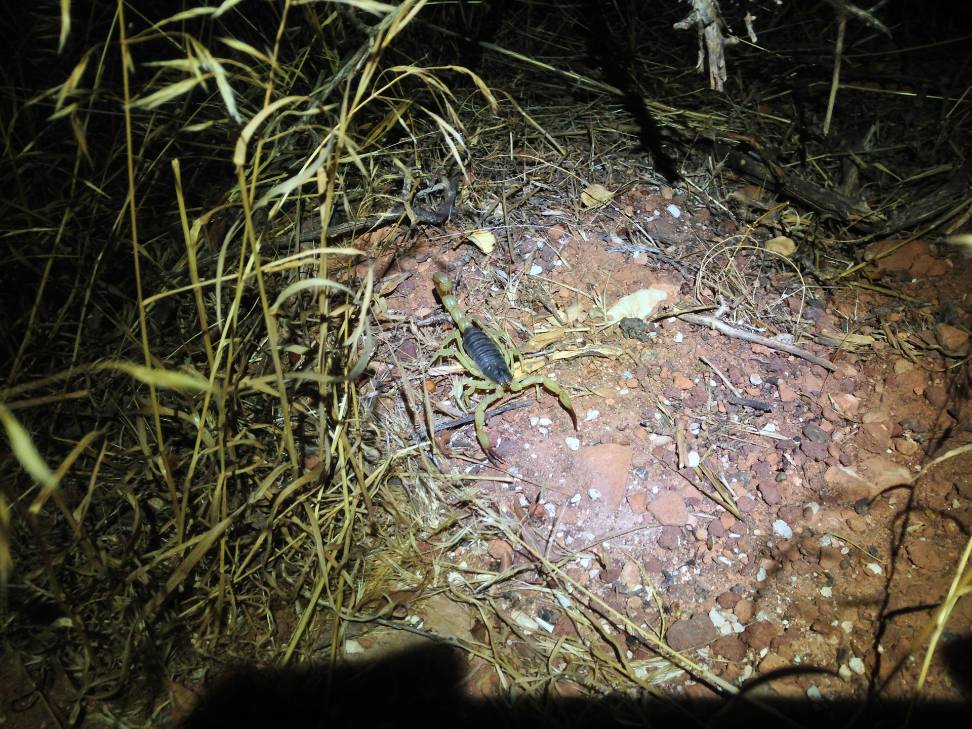
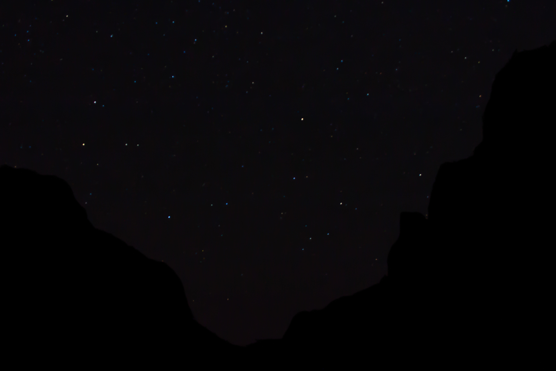
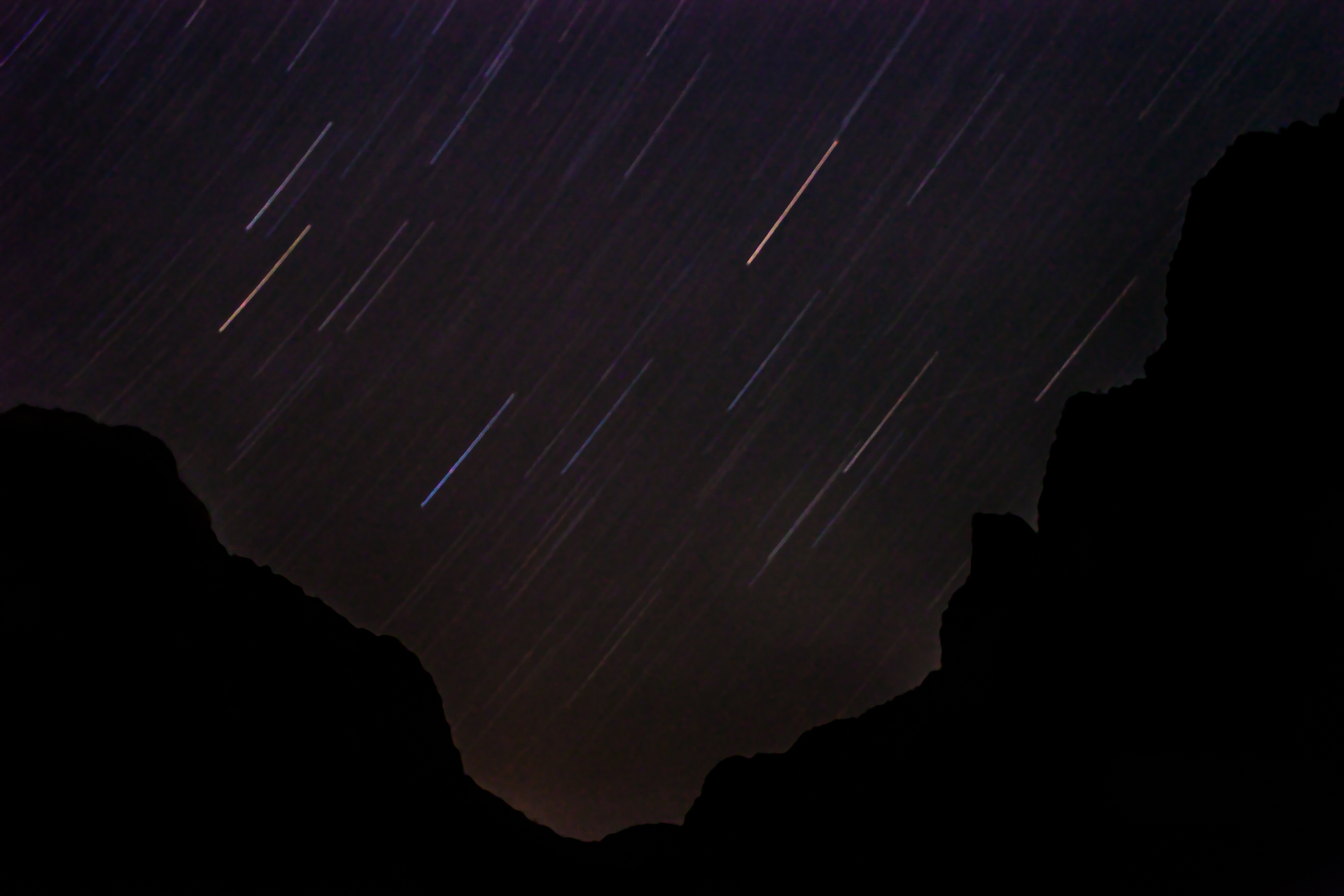
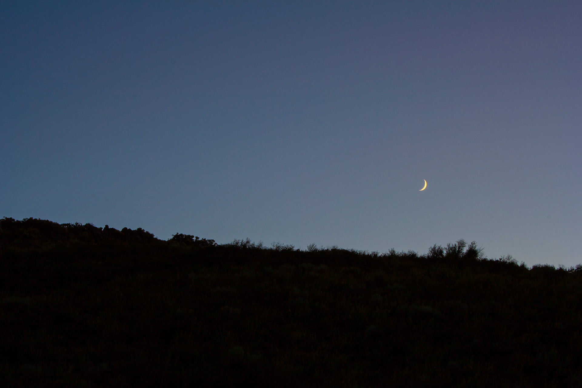
Later that evening, I drove back along the Zion-Mount Carmel highway, stopping a few miles from the east entrance to try to get a few pictures of the stars above the canyon. That didn't work out as well as I had hoped, but I did see another scorpion!
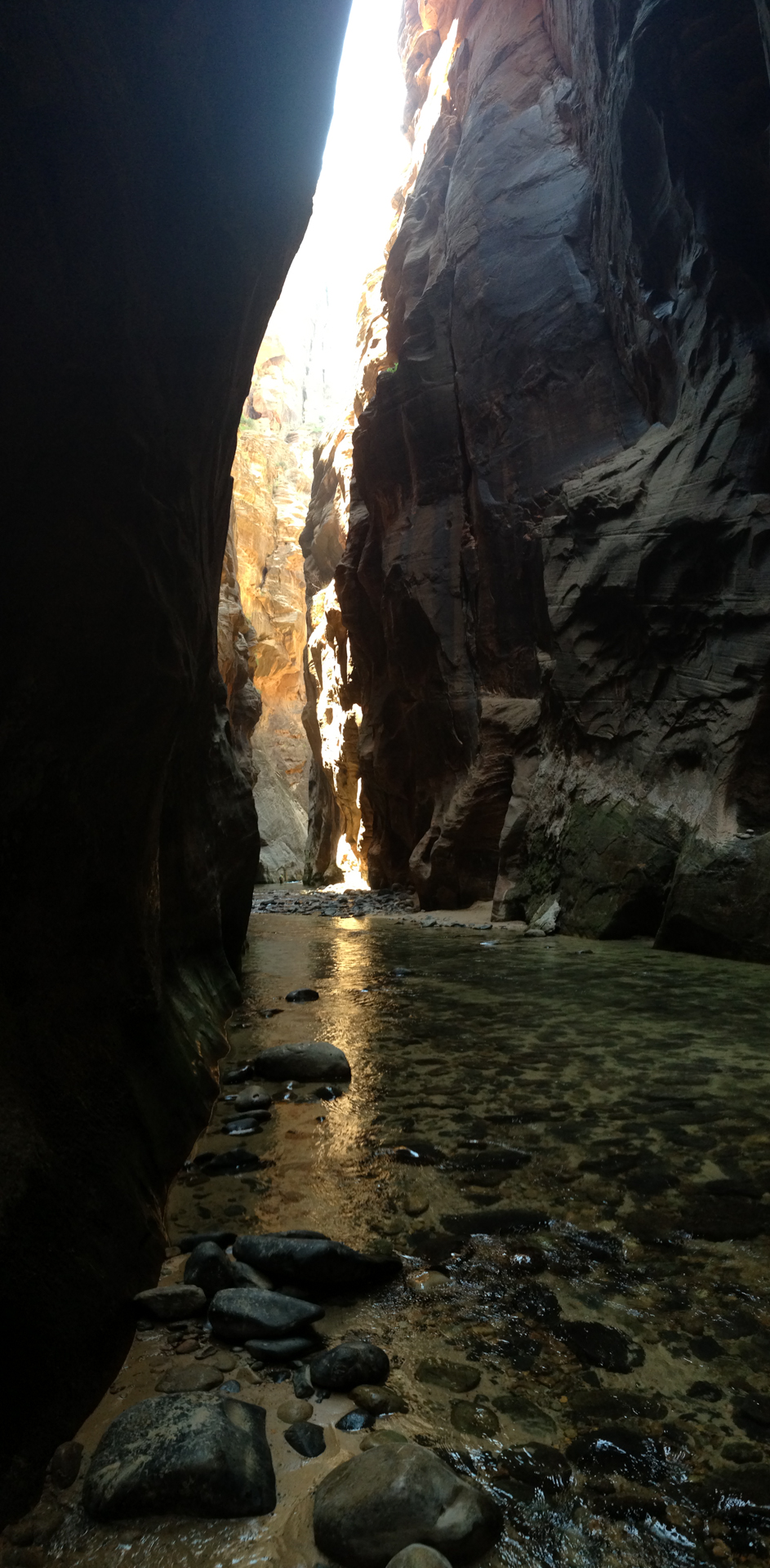
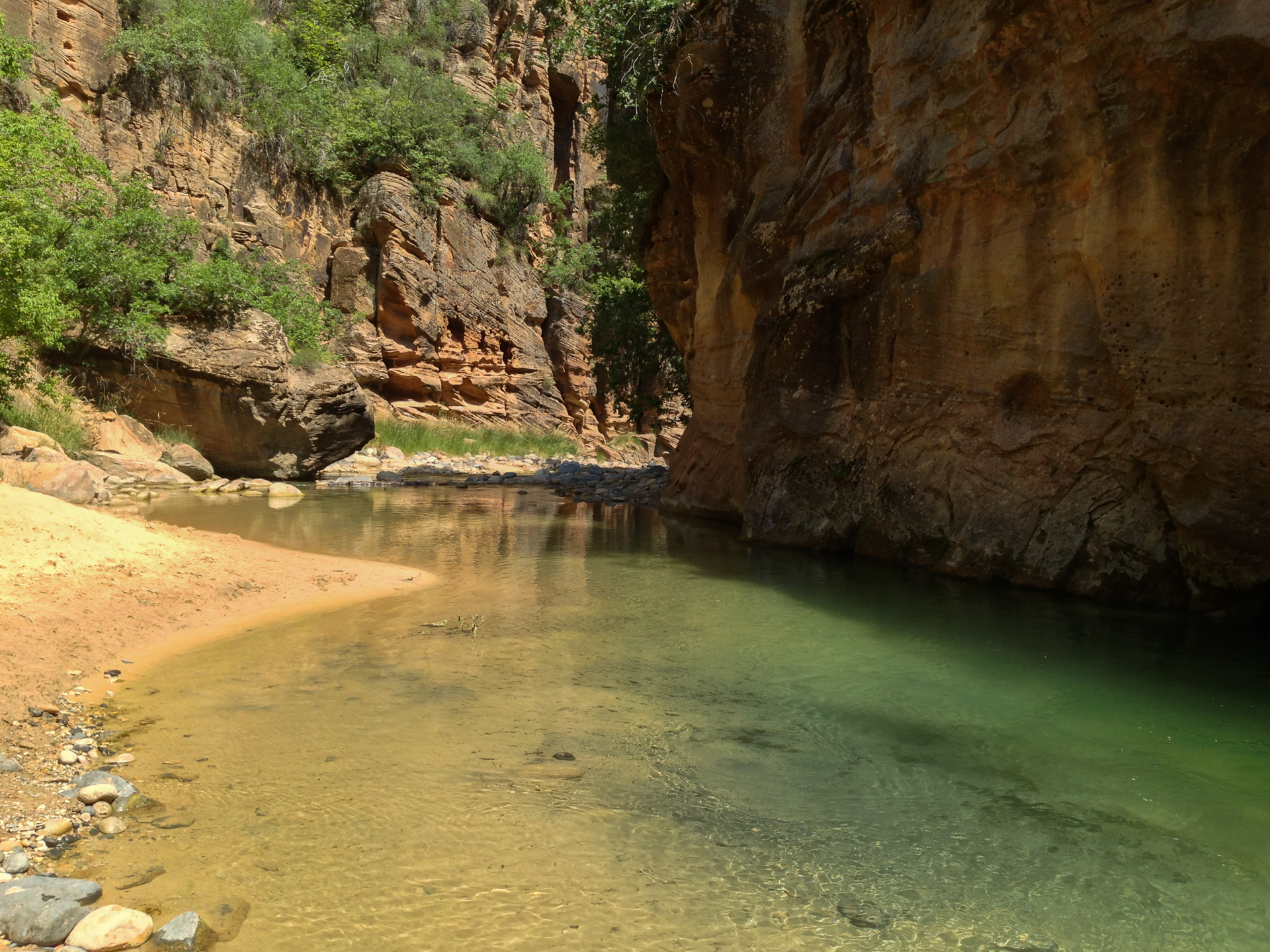
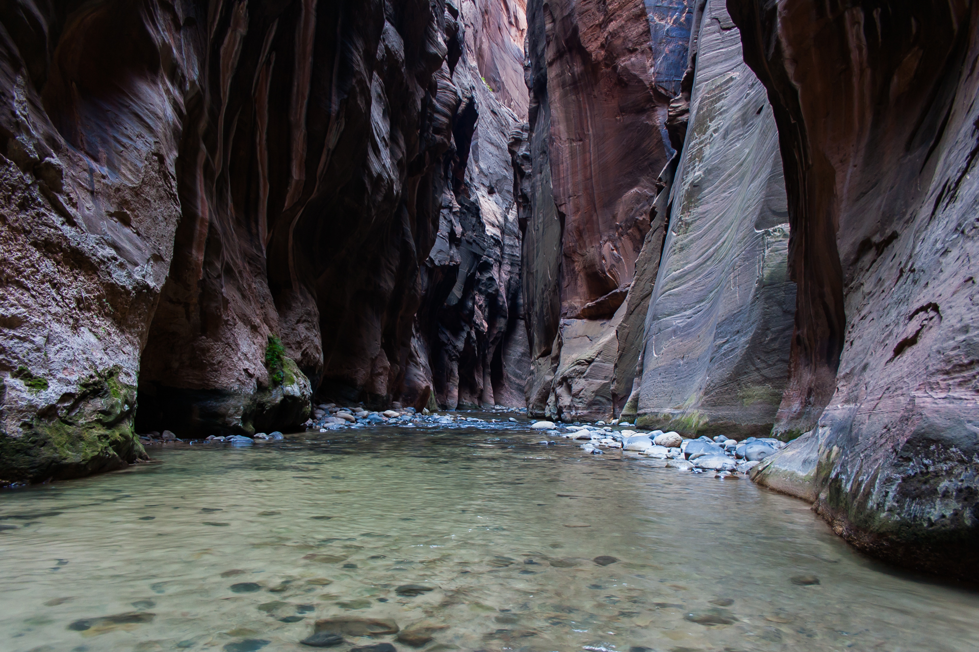
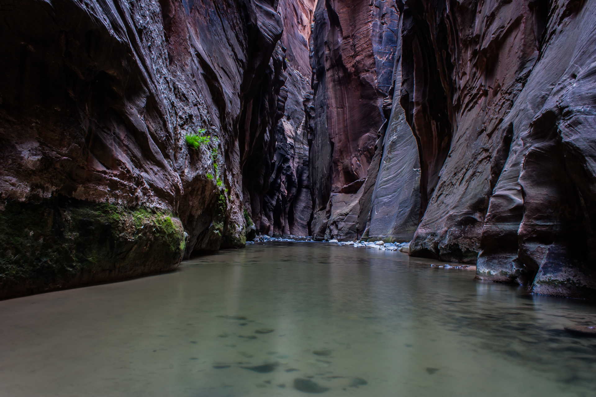
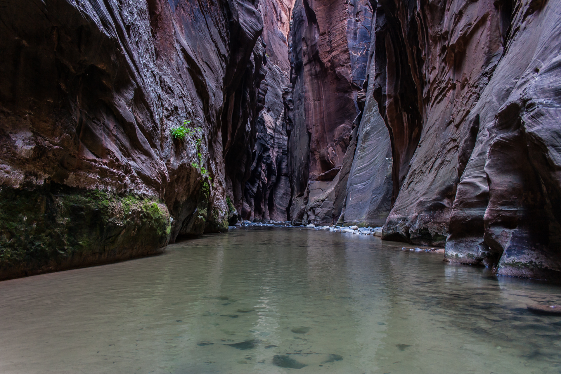
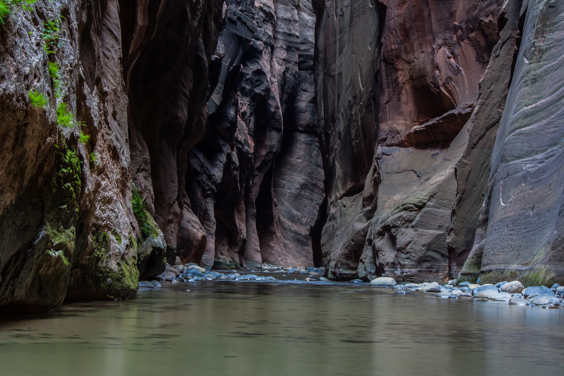
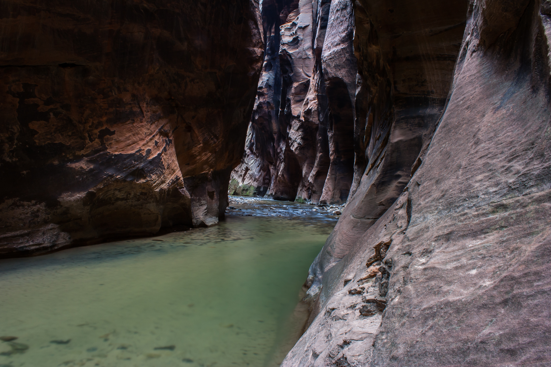
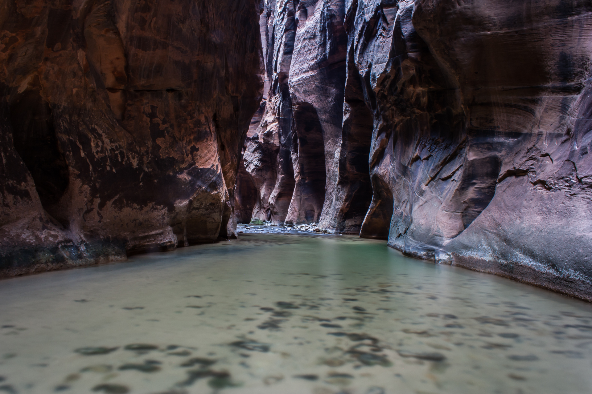
The next day, I set off to hike The Narrows, a 16-mile (25km) long, 20-30 foot (6-9m) wide, 2000 foot (610m) deep gorge carved by the Virgin River. What makes The Narrows unique is that there is no hiking trail at all: the hike is actually undertaken in the river. As such, it can vary greatly in difficulty depending on the season; during months where the water level is high, it can be all but impassable, whereas in the summer it tends to be relatively easy with water ranging from ankle-deep to waist-deep. As I was in Zion during July, the water level was quite low.
Even so, such an atypical hike requires extra preparation, so I walked across the road from my campground to the Zion Adventure Company and picked up the required gear. This consisted of a pair of canyoneering shoes and neoprene socks, a walking stick, and a waterproof bag for my camera equipment. I ended up finding the walking stick to be more of a burden than a boon, and the waterproof bag wasn't really necessary either given the low water levels, but it's better to be safe than sorry with expensive camera equipment.
A word of advice for anyone planning to hike The Narrows, though: if you rent canyoneering shoes, make sure they fit with plenty of room to spare. They'll shrink in the water, so shoes that are a comfortable fit at the beginning of the day can become very, very uncomfortable after several hours in the river. I learned this the hard way: by the end of my hike, I could barely walk, and much of the toenail on my big toe on my left foot ended up turning black and falling off. Five months later, it's finally almost completely grown back.
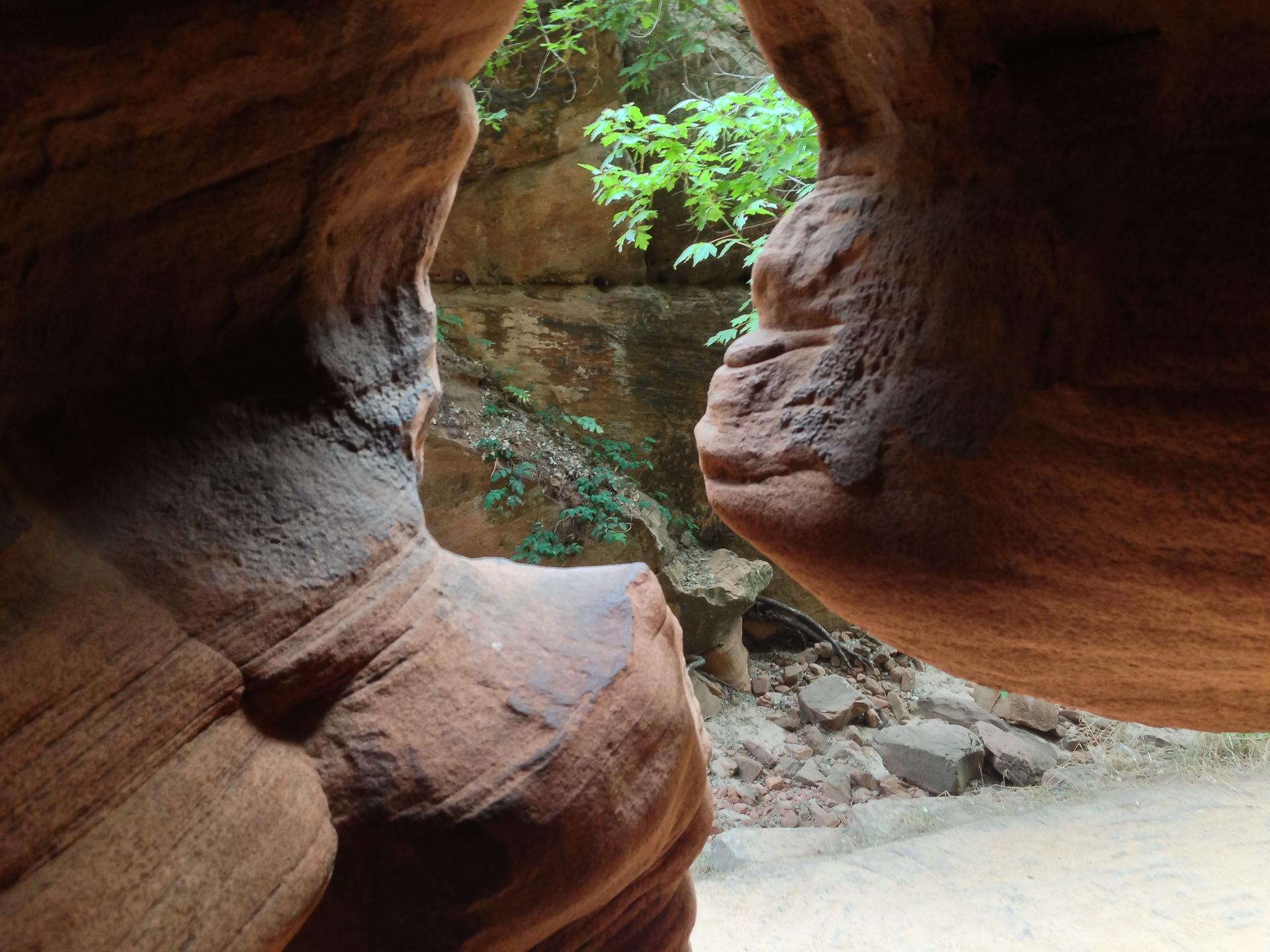
Aside from that slightly painful mistake on my part, though, The Narrows proved to be a truly amazing hike, unlike anything I've ever done before. Looking thousands of feet up the sheer canyon wall offers a new perspective on the enormity of Zion Canyon, and there's something new to see in every corner of the canyon: foliage sprouting out of the ancient stone, birds circling overhead, gurgling springs pouring from cracks in the walls, and all around, the ever-changing Virgin River.
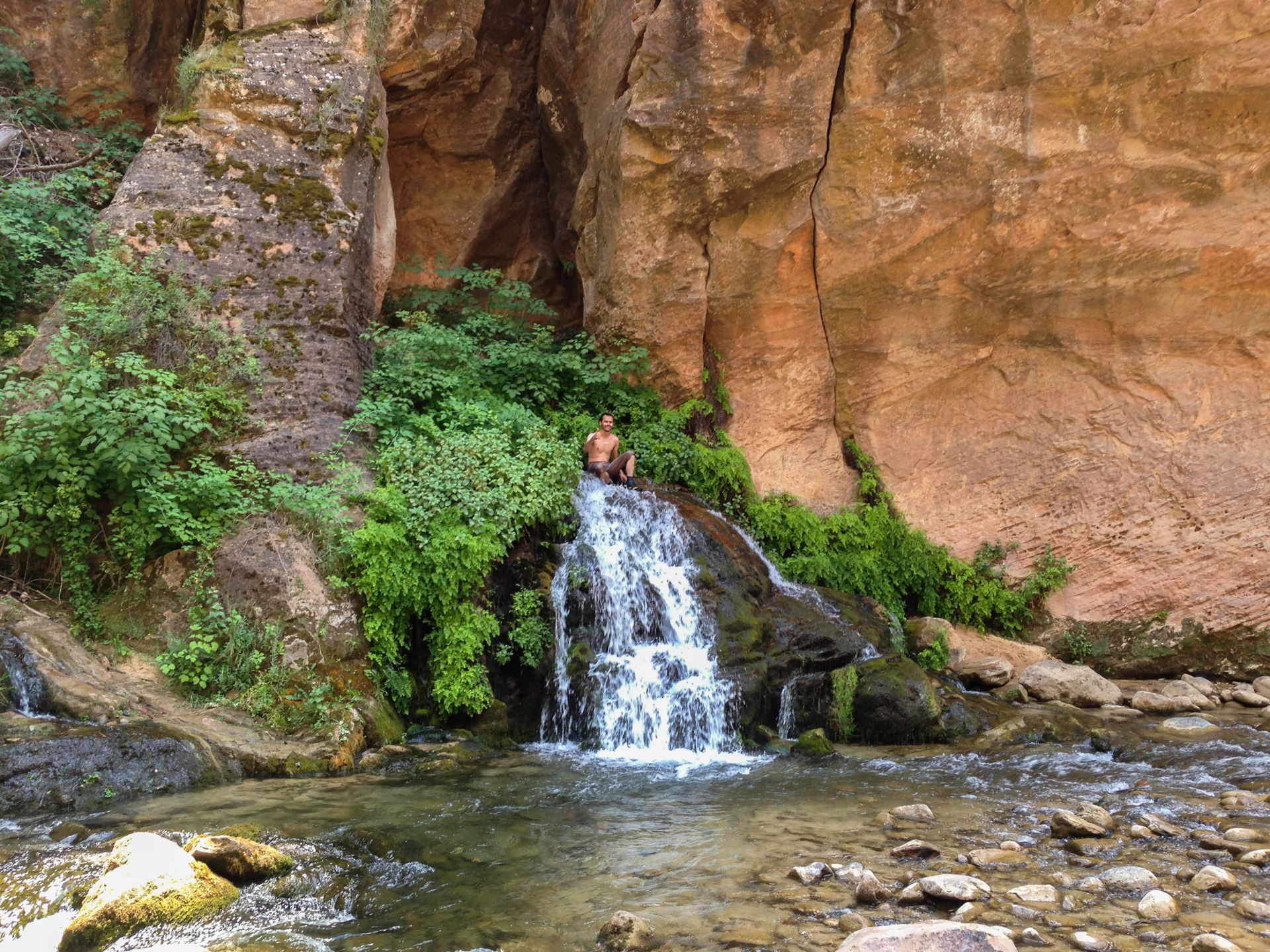
There are two ways to hike The Narrows. Starting from the top down, it's a 16-mile hike, which the National Park Service estimates will take about 12 hours. Unfortunately, this route requires two permits, one of which is very sought-after and therefore difficult to get. Not having either permit, I was left with the bottom-up hike, which is a 10-mile (16km) round trip if you go all the way to the mandatory turn-around point at Big Spring, which I did. I also took the optional side-trip into Orderville Canyon, which added another mile to the hike for a total of around 11 miles (18km).
The first few miles of the hike were very busy, probably owing both to how spectacular the views on the hike are, and how refreshing the cool waters of the Virgin River are on hot days in Zion. Luckily, most people seem to stop and turn back around Orderville Canyon, which is about 2.5 miles into the hike. After the Orderville fork, the main canyon becomes very narrow in spots—hence the name. Of course, this also means that the river is much deeper in a few areas. Even with the low water levels, I had to wade through several waist-deep pools with my camera bag held above my head. There was even one pool deep enough that I would have had to swim across it, but I managed to find an alternate route by sneaking behind a colossal boulder in the river.
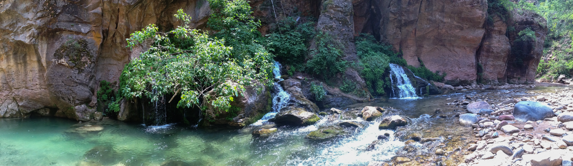
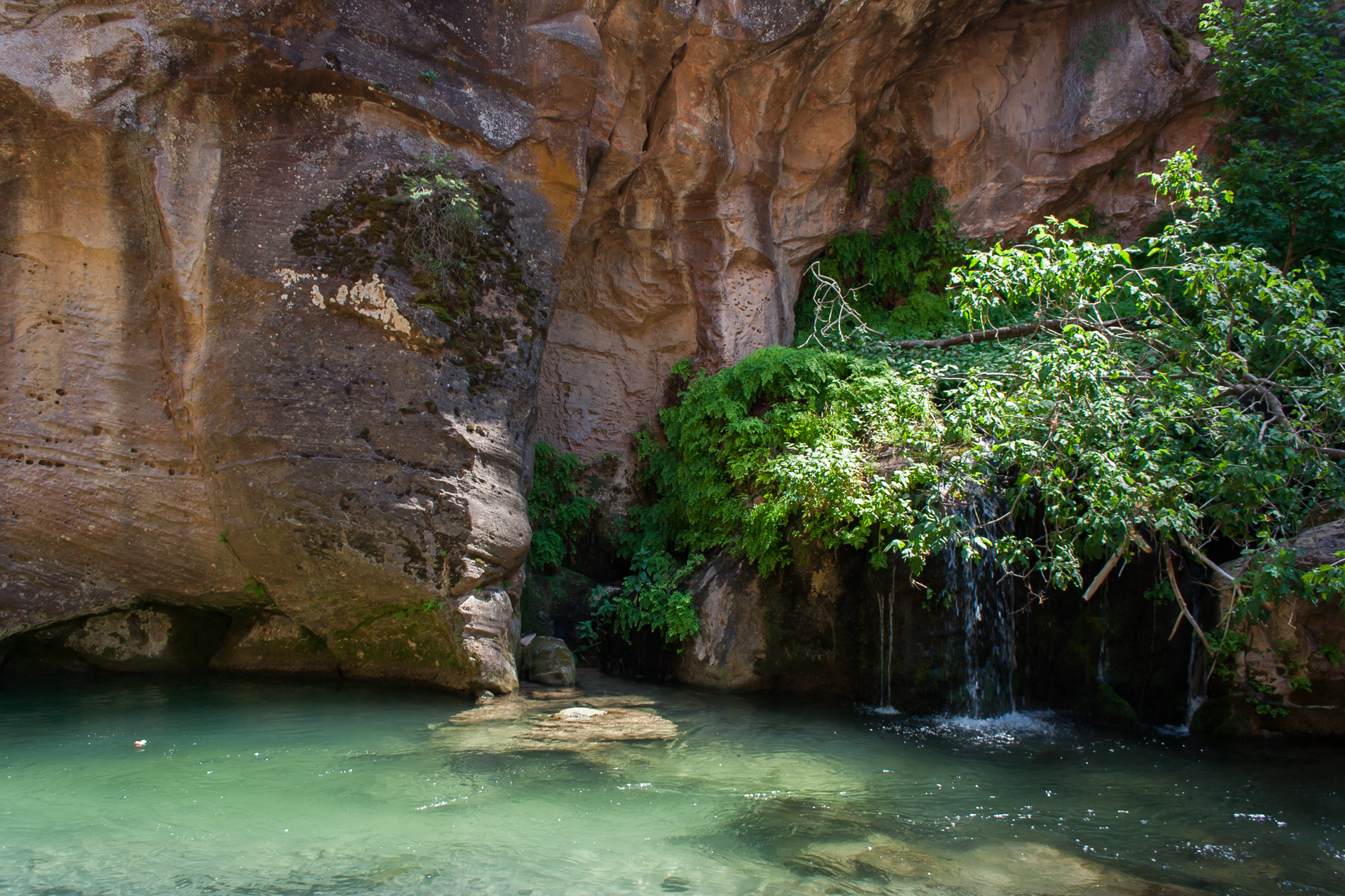
After five miles of walking upstream, I reached Big Spring, which is exactly what it sounds like: a large spring pouring into the river from the canyon wall. With the water low, it's also a perfect spot to stop and relax. There's a nice sandbar to sit on, and the canyon is wide enough that the afternoon sun bakes the sandbar to a pleasantly warm temperature. There's also a fairly deep pool in the river opposite the sandbar, adjacent to the spring itself; this I found to be perfect for diving and swimming, and a nice way to cool off when the sun became too warm.
I met a group of students and their football coach from a Mormon school in Provo (if I recall correctly) at the spring. They were all very friendly, and I encountered them again several times on my way back down the canyon, so we ended up chatting about various subjects. Learning that I'm from Canada but working in the US, they were interested to hear how Canadians can acquire US work visas. This is something I've been asked about several times; it seems that some aspects of the US immigration system are almost universally unknown. I don't mean that to sound judgmental, though—it's merely an (I think) interesting observation. Most people have little reason to know, and I can't claim to understand in detail how immigration works in Canada.
They also mentioned that they knew someone who was currently on a mission in Edmonton, which is where I went to school. I was a little surprised to learn that Mormons from the US actually go on missions in Canada; I guess I had pictured missions primarily taking place in poorer countries where the missionaries can help the locals with construction, education, health care, and so forth, in addition to their evangelism. I didn't really ask about it, though; mostly we talked about how mind-numbingly cold winters in Edmonton can be.
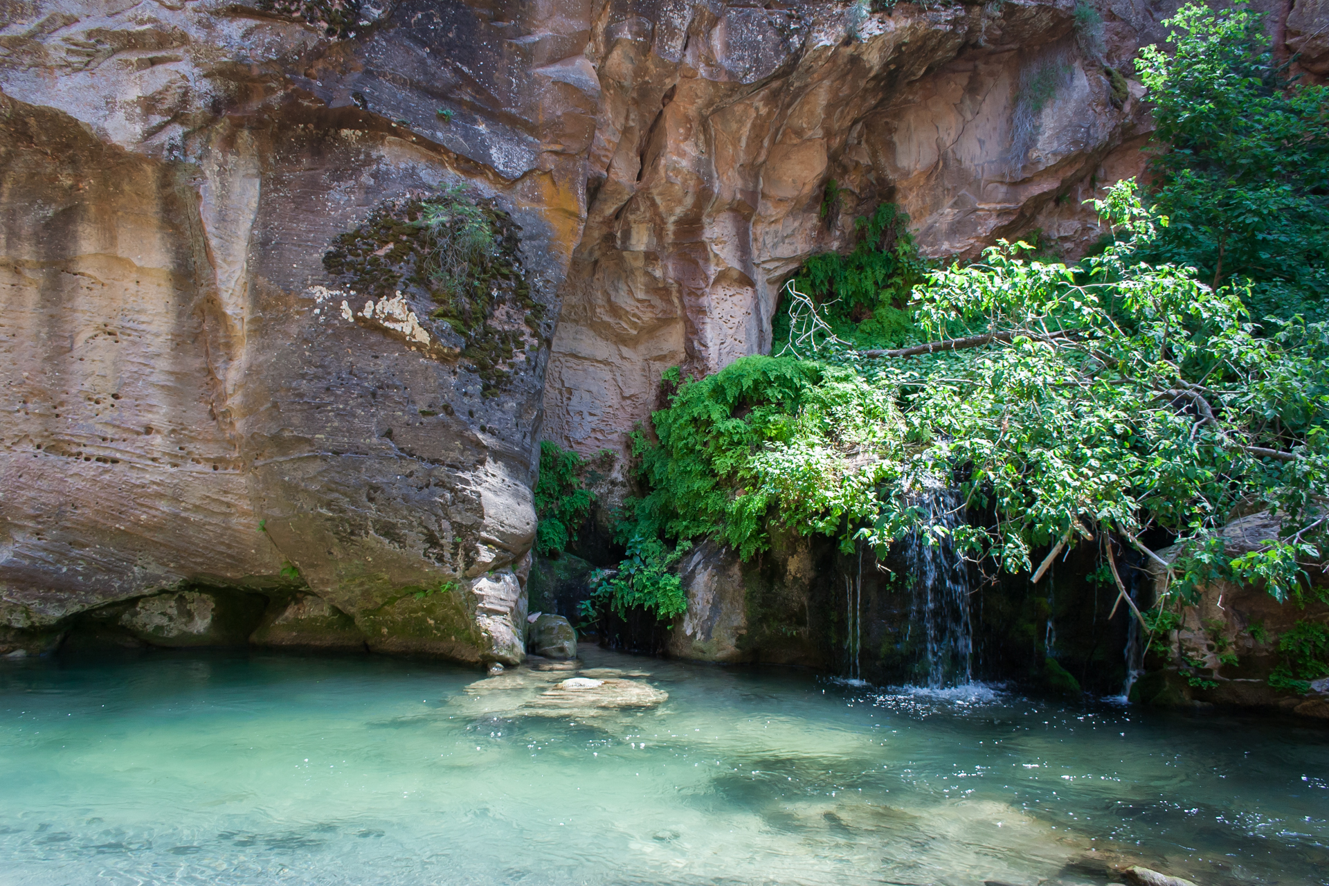
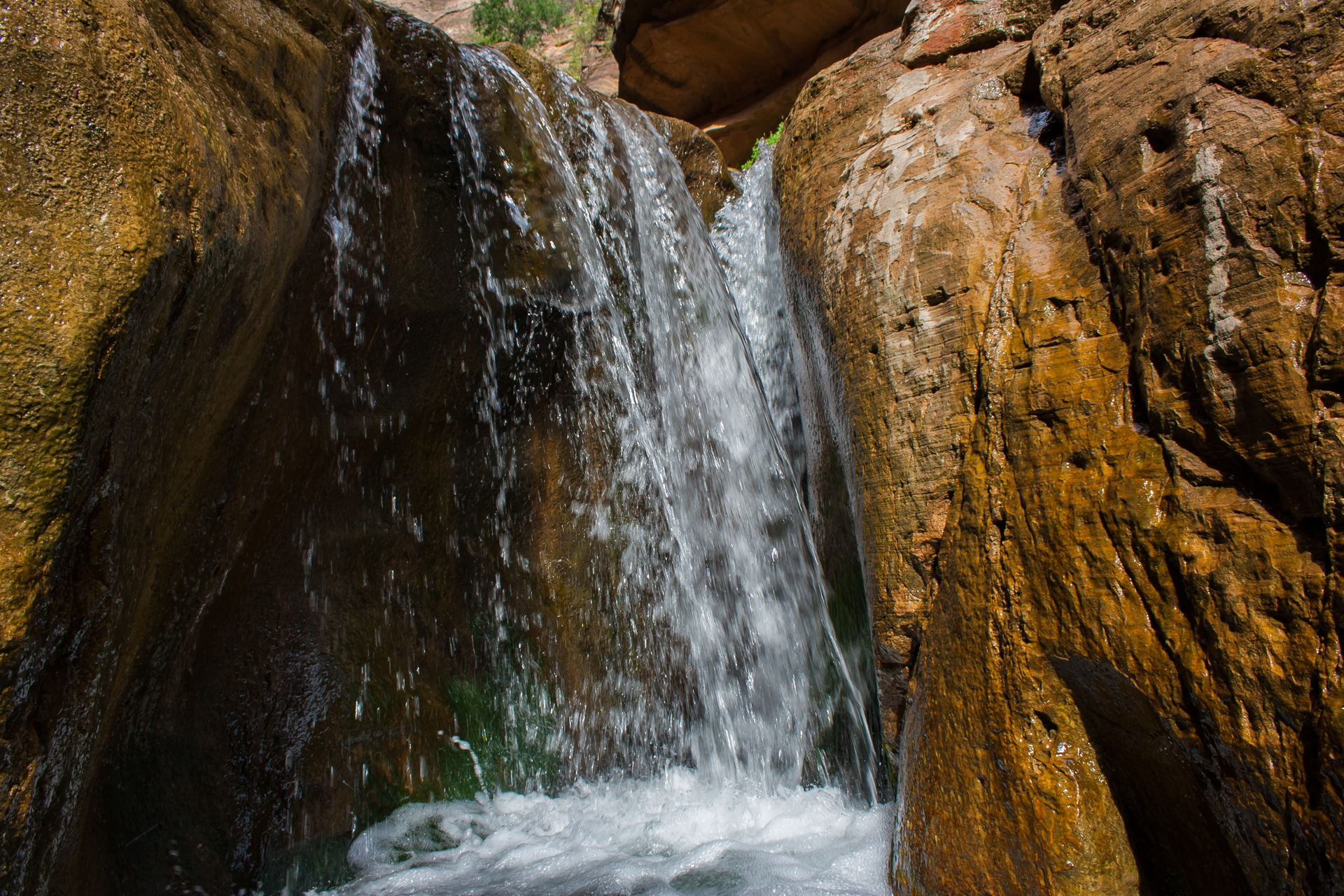
On my way back down the river, I stopped briefly in Orderville Canyon. It's a short detour, and well worth it. Orderville is narrower than the main canyon, and a bit more challenging to hike in some spots. After one of the first several bends, there's a long straight stretch with a clear view to a jutting peak above the canyon, which offers a phenomenal sense of the scale of the stone around you. Unfortunately, I couldn't effectively photograph this. At the turn-around point, Orderville rewards those who take the time to hike it with a small waterfall.


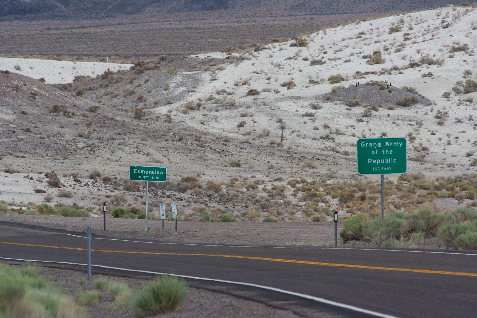
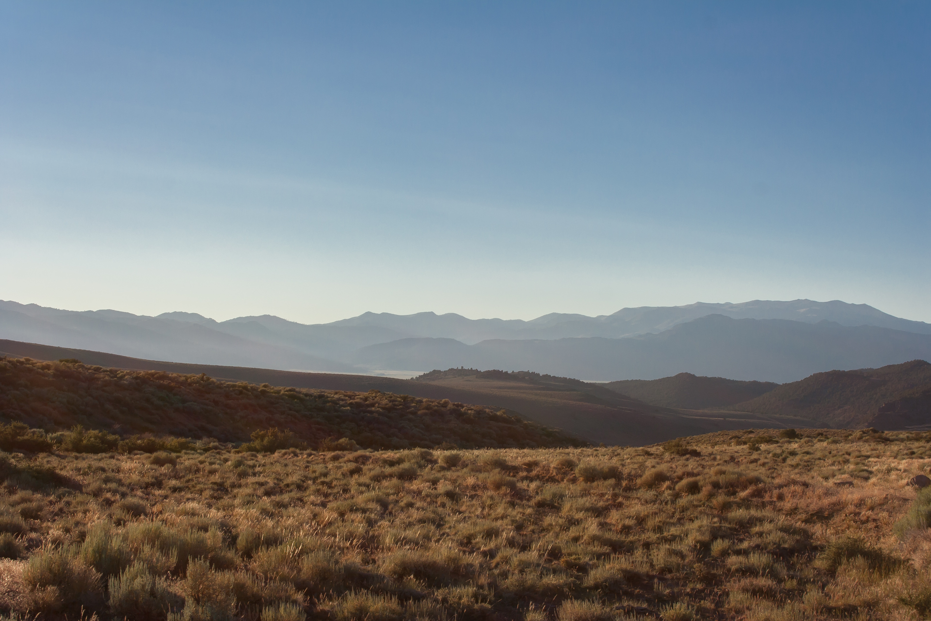
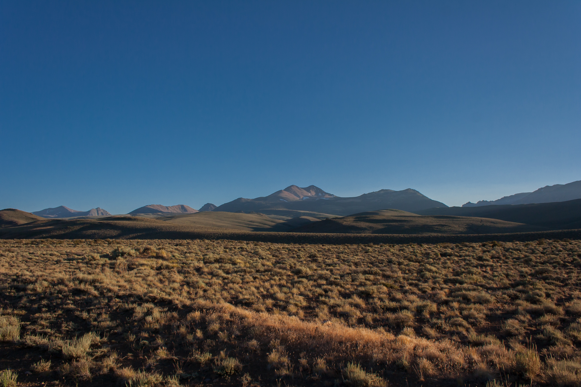
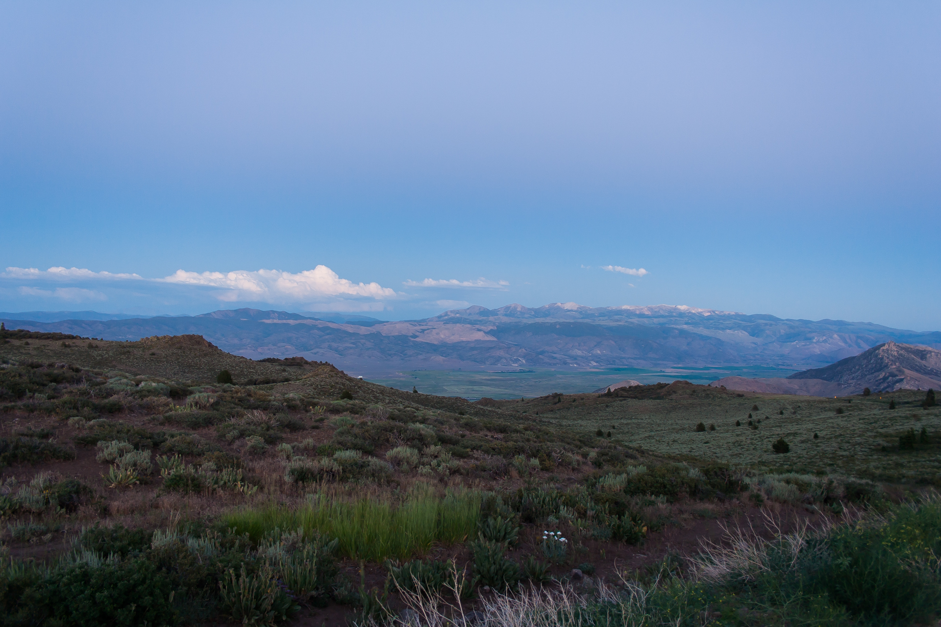
Sadly, I only had a couple days to spend in Zion, so the next day I packed up my tent and started the long drive back to Redmond. The fastest route would have been to back north through Idaho, essentially following the same route I'd arrived on. I wanted the drive to be interesting, though, so instead I headed southwest to St. George, Utah, then through the northwest corner of Arizona and on to Las Vegas. (There's a map in my first post.) From there, I drove northwest along the California-Nevada border. The GPS in my car can be extremely uncooperative at times, particularly where seasonal roads are involved, so I ended up following an unnecessarily circuitous route, crossing the state border no fewer than 5 times. I did find some beautiful roads, though; in particular, the Robert M. Jackson Memorial Highway (California State Route 89) near Leviathan Peak. I reached the peak just as the sun was setting, and the view was gorgeous.
I stayed the night in South Lake Tahoe. It was already night when I arrived, and I didn't have much time to explore the next day given how much driving I still had left to do. Still, driving around the lake re-emphasized the beauty of the area; Lake Tahoe now has a high spot on my list of places that I have to visit.
From Tahoe, I made another detour back into Nevada, through Carson City, and then back through California up to Oregon. Northern California reminds me quite a bit of the southern interior of British Columbia, but other than that, there wasn't much to see. As for the drive through Oregon, the only thing I want to say about it is that south-central Oregon doesn't seem to be very interesting (except for Crater Lake, which I didn't get a chance to stop at), and that speed limits in the state are far too low. 55mph on the interstate makes for a long, boring drive.


So, that's it! I hope you've enjoyed reading about my adventures. I try to do at least one long road trip each year, so if you have suggestions about where I should go next year, let me know.